Newtownabbey night lights from space
Night Light of Newtownabbey (Northern Ireland) from space (United Kingdom) Src. Average luminocity for 10x10km area is 67.9762% and for 50x50km: 14.4887%.
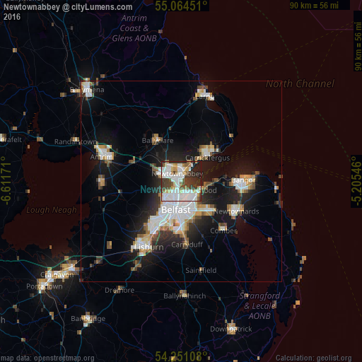
Analysis of Newtownabbey night lights 2016
Square area 10x10 km:
 23.68%
90-99
19.42%80-89
5.89%70-79
5.39%60-69
3.88%50-59
4.89%40-49
7.52%30-39
12.28%20-29
11.4%10-19
5.64%0-9
0%Square area 50x50 km:
3.17%90-99
3.23%80-89
0.93%70-79
1.52%60-69
1.24%50-59
1.45%40-49
1.56%30-39
1.88%20-29
3.81%10-19
10.14%0-9
71.08%Clear (daylight) street map image can be seen on geolist.org.
Map coordinates:
55° 3' 52.2" North, 6° 36' 42.2" West
54° 39' 35.4" North, 5° 54' 30.9" West
54° 15' 3.9" North, 5° 12' 19.7" West
Some cities around Newtownabbey sort by population:
• Belfast
7.1 km =4.4 mi,  188°
188°
• Castlereagh
9.7 km =6 mi,  170°
170°
• Carrickfergus
9.1 km =5.7 mi,  46°
46°
• Dundonald
10.4 km =6.5 mi,  136°
136°
• Holywood
5.9 km =3.7 mi,  113°
113°
• Ballyclare
11.7 km =7.3 mi,  330°
330°
• Jordanstown
2.7 km =1.7 mi,  11°
11°
• Greenisland
5 km =3.1 mi,  25°
25°
2641520 (p: 63,860)
Sources (retrieved 2019-11-25):
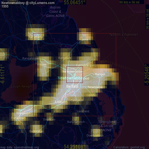
» NASA, Earths city lights 1995
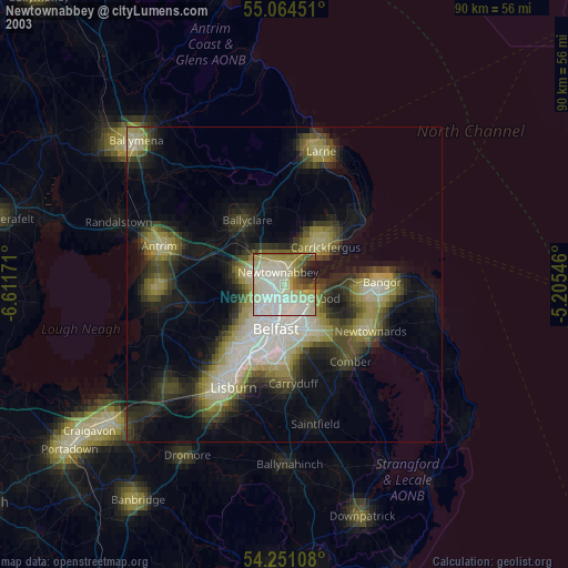
» NASA city lights 2003
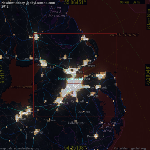
» Earth at Night: Flat Maps 2012, 2016