Castlereagh night lights from space
Night Light of Castlereagh (Northern Ireland) from space (United Kingdom) Src. Average luminocity for 10x10km area is 65.5945% and for 50x50km: 13.7441%.
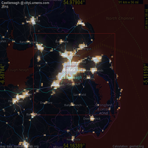
Analysis of Castlereagh night lights 2016
Square area 10x10 km:
 23.33%
90-99
19.5%80-89
5.26%70-79
7.18%60-69
4.9%50-59
3.23%40-49
3.47%30-39
5.62%20-29
14.59%10-19
9.69%0-9
3.23%Square area 50x50 km:
2.97%90-99
2.97%80-89
0.87%70-79
1.45%60-69
1.22%50-59
1.44%40-49
1.46%30-39
1.96%20-29
3.83%10-19
9.74%0-9
72.08%Clear (daylight) street map image can be seen on geolist.org.
Map coordinates:
54° 58' 44.5" North, 6° 35' 16.2" West
54° 34' 24.6" North, 5° 53' 5" West
54° 9' 50" North, 5° 10' 53.7" West
Some cities around Castlereagh sort by population:
• Belfast
3.7 km =2.3 mi,  314°
314°
• Lisburn
11.2 km =7 mi,  240°
240°
• Newtownabbey
9.7 km =6 mi,  350°
350°
• Dundonald
6 km =3.7 mi,  69°
69°
• Holywood
8.2 km =5.1 mi,  28°
28°
• Comber
9.5 km =5.9 mi,  106°
106°
• Carryduff
6.2 km =3.9 mi,  181°
181°
• Jordanstown
12.3 km =7.6 mi,  355°
355°
2653558 (p: 56,679)
Sources (retrieved 2019-11-25):
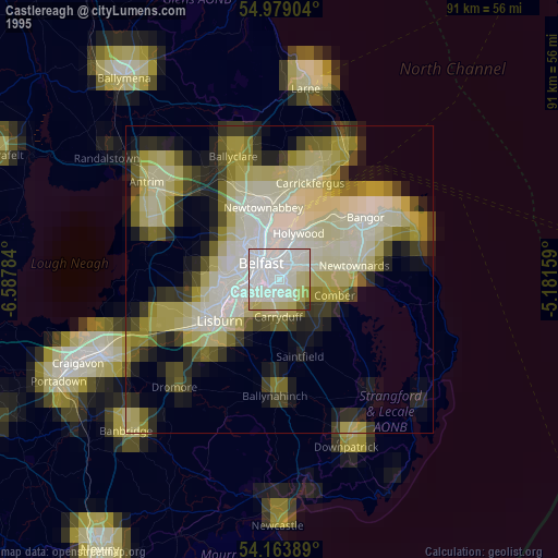
» NASA, Earths city lights 1995
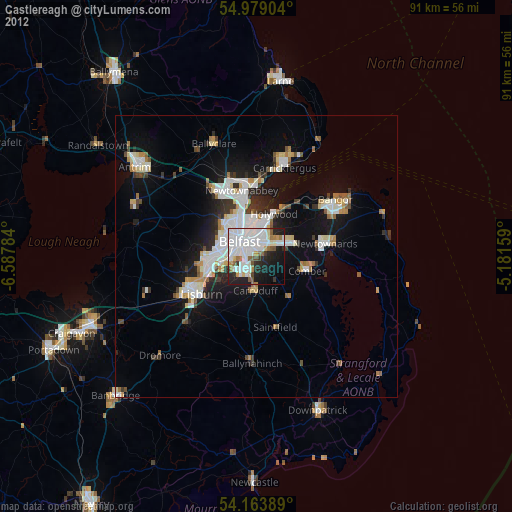
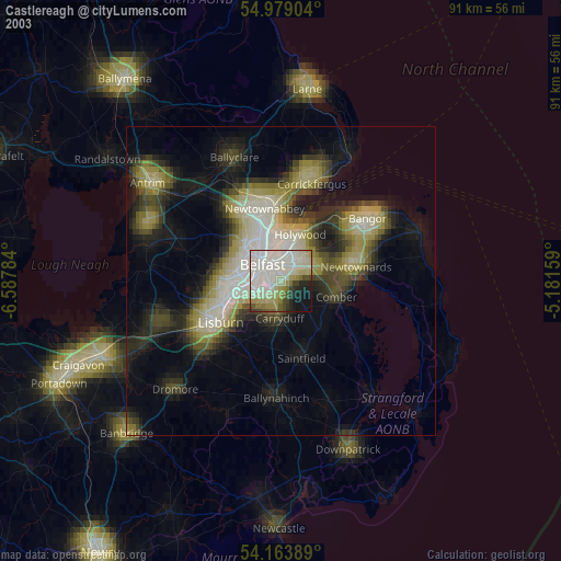
» NASA city lights 2003
» Earth at Night: Flat Maps 2012, 2016