Neston night lights from space
Night Light of Neston (England) from space (United Kingdom) Src. Average luminocity for 10x10km area is 24.8258% and for 50x50km: 28.3171%.
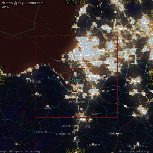
Analysis of Neston night lights 2016
Square area 10x10 km:
 1.39%
1.39%90-99
2.4%80-89
1.01%70-79
1.26%60-69
3.16%50-59
2.65%40-49
3.03%30-39
3.91%20-29
26.39%10-19
41.79%0-9
13.01%Square area 50x50 km:
8.19%90-99
6.68%80-89
2.34%70-79
2.18%60-69
2.51%50-59
2.79%40-49
3.71%30-39
5.03%20-29
6.78%10-19
8.64%0-9
51.16%Clear (daylight) street map image can be seen on geolist.org.
Map coordinates:
53° 42' 5.9" North, 3° 45' 11.3" West
53° 16' 60" North, 3° 3' 0" West
52° 51' 39.2" North, 2° 20' 48.8" West
Some cities around Neston sort by population:
• Ellesmere Port
9.9 km =6.2 mi,  92°
92°
• Deeside
9.2 km =5.7 mi,  175°
175°
• Heswall
5.8 km =3.6 mi,  327°
327°
• Flint
6.9 km =4.3 mi,  232°
232°
• Bebington
7.7 km =4.8 mi,  16°
16°
• Bromborough
8.6 km =5.3 mi,  32°
32°
• Prenton
9.4 km =5.8 mi,  358°
358°
• New Ferry
9.4 km =5.8 mi, 23°
2641795 (p: 15,064)
Sources (retrieved 2019-11-25):
» Earth at Night: Flat Maps 2012, 2016