Heswall night lights from space
Night Light of Heswall (England) from space (United Kingdom) Src. Average luminocity for 10x10km area is 27.0934% and for 50x50km: 27.5583%.
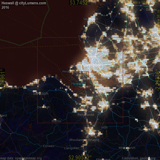
Analysis of Heswall night lights 2016
Square area 10x10 km:
 1.01%
1.01%90-99
3.03%80-89
2.53%70-79
1.89%60-69
3.16%50-59
3.79%40-49
7.58%30-39
10.23%20-29
13.89%10-19
26.14%0-9
26.77%Square area 50x50 km:
7.9%90-99
6.45%80-89
2.06%70-79
2.14%60-69
2.33%50-59
2.25%40-49
3.38%30-39
5.43%20-29
8.14%10-19
9.04%0-9
50.88%Clear (daylight) street map image can be seen on geolist.org.
Map coordinates:
53° 44' 42.7" North, 3° 47' 58.6" West
53° 19' 38.4" North, 3° 5' 47.3" West
52° 54' 19.2" North, 2° 23' 36.1" West
Some cities around Heswall sort by population:
• Moreton
8.2 km =5.1 mi,  350°
350°
• Bebington
5.9 km =3.7 mi,  64°
64°
• Neston
5.8 km =3.6 mi,  147°
147°
• Bromborough
8.1 km =5 mi,  73°
73°
• Prenton
5.3 km =3.3 mi,  31°
31°
• Greasby
5.4 km =3.4 mi,  340°
340°
• West Kirby
7.7 km =4.8 mi,  311°
311°
• New Ferry
7.7 km =4.8 mi, 61°
2647026 (p: 29,789)
Sources (retrieved 2019-11-25):
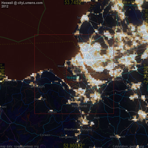
» Earth at Night: Flat Maps 2012, 2016