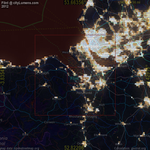
Flint night lights from space
Night Light of Flint (Wales) from space (United Kingdom) Src. Average luminocity for 10x10km area is 18.8624% and for 50x50km: 23.2705%.
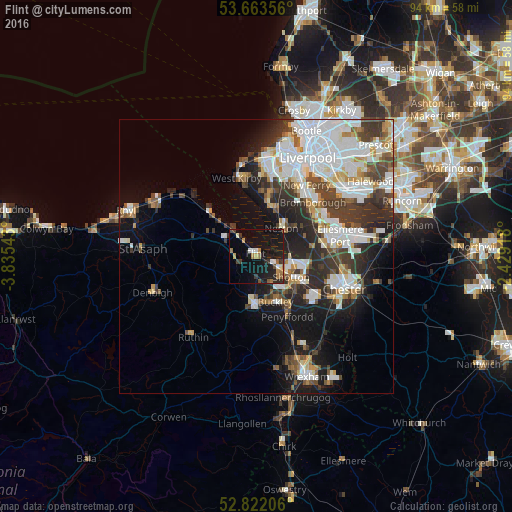
Analysis of Flint night lights 2016
Square area 10x10 km:
100  1.14%
1.14%
90-99 2.4%
80-89 0.88%
70-79 2.4%
60-69 3.66%
50-59 2.02%
40-49 1.64%
30-39 3.16%
20-29 5.68%
10-19 26.14%
0-9 50.88%
1.14%90-99
2.4%80-89
0.88%70-79
2.4%60-69
3.66%50-59
2.02%40-49
1.64%30-39
3.16%20-29
5.68%10-19
26.14%0-9
50.88%Square area 50x50 km:
100 6.69%
90-99 5.19%
80-89 1.76%
70-79 1.73%
60-69 1.99%
50-59 2.14%
40-49 2.93%
30-39 4.4%
20-29 5.93%
10-19 9.21%
0-9 58.05%
6.69%90-99
5.19%80-89
1.76%70-79
1.73%60-69
1.99%50-59
2.14%40-49
2.93%30-39
4.4%20-29
5.93%10-19
9.21%0-9
58.05%Clear (daylight) street map image can be seen on geolist.org.
Map coordinates:
53° 39' 48.8" North, 3° 50' 7.5" West
53° 14' 41.6" North, 3° 7' 56.3" West
52° 49' 19.4" North, 2° 25' 45" West
Some cities around Flint sort by population:
• Buckley
9.3 km =5.8 mi,  159°
159°
• Deeside
8 km =5 mi,  128°
128°
• Heswall
9.5 km =5.9 mi,  14°
14°
• Hawarden
9.7 km =6 mi, 133°
• Neston
6.9 km =4.3 mi,  52°
52°
• Mold
8.7 km =5.4 mi,  183°
183°
• Holywell
7.2 km =4.5 mi,  297°
297°
• Broughton
13 km =8.1 mi, 134°
2649301 (p: 26,442)
Sources (retrieved 2019-11-25):
» Earth at Night: Flat Maps 2012, 2016