Morpeth night lights from space
Night Light of Morpeth (England) from space (United Kingdom) Src. Average luminocity for 10x10km area is 9.8947% and for 50x50km: 13.4087%.
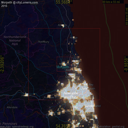
Analysis of Morpeth night lights 2016
Square area 10x10 km:
 1%
1%90-99
0.5%80-89
0.75%70-79
1.63%60-69
1.13%50-59
1.63%40-49
1.5%30-39
1.13%20-29
1.25%10-19
6.27%0-9
83.21%Square area 50x50 km:
4.5%90-99
3.23%80-89
1.27%70-79
1.02%60-69
0.97%50-59
1.04%40-49
0.99%30-39
1.83%20-29
2.82%10-19
3.96%0-9
78.37%Clear (daylight) street map image can be seen on geolist.org.
Map coordinates:
55° 34' 6.2" North, 2° 23' 31.4" West
55° 10' 7.8" North, 1° 41' 20.1" West
54° 45' 54.7" North, 0° 59' 8.9" West
Some cities around Morpeth sort by population:
• Blyth
12.4 km =7.7 mi,  112°
112°
• Cramlington
11.3 km =7 mi,  144°
144°
• Ashington
8 km =5 mi,  83°
83°
• Bedlington
7.4 km =4.6 mi,  124°
124°
• Ponteland
13.7 km =8.5 mi,  195°
195°
• Stakeford
7.3 km =4.5 mi,  96°
96°
• Wideopen
14.4 km =8.9 mi,  162°
162°
• Newbiggin-by-the-Sea
11.2 km =7 mi, 80°
2642182 (p: 14,403)
Sources (retrieved 2019-11-25):
» Earth at Night: Flat Maps 2012, 2016