Minehead night lights from space
Night Light of Minehead (England) from space (United Kingdom) Src. Average luminocity for 10x10km area is 1.6625% and for 50x50km: 1.8395%.
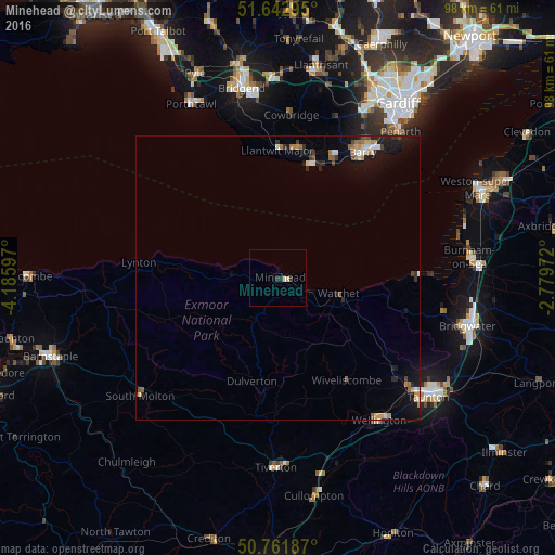
Analysis of Minehead night lights 2016
Square area 10x10 km:
 0%
0%90-99
0.56%80-89
0.56%70-79
0%60-69
0%50-59
0%40-49
0%30-39
0.56%20-29
1.12%10-19
0%0-9
97.2%Square area 50x50 km:
0.17%90-99
0.25%80-89
0.2%70-79
0.23%60-69
0.27%50-59
0.27%40-49
0.16%30-39
0.21%20-29
0.56%10-19
1.55%0-9
96.13%Clear (daylight) street map image can be seen on geolist.org.
Map coordinates:
51° 38' 34.6" North, 4° 11' 9.5" West
51° 12' 16.3" North, 3° 28' 58.2" West
50° 45' 42.7" North, 2° 46' 47" West
Some cities around Minehead sort by population:
• Taunton
33.9 km =21.1 mi,  128°
128°
• Barry
25.7 km =16 mi,  32°
32°
• Penarth
33.8 km =21 mi,  39°
39°
• Tiverton
33.6 km =20.9 mi,  181°
181°
• Llantwit Major
22.9 km =14.2 mi,  359°
359°
• Dinas Powys
31.7 km =19.7 mi, 36°
• Rhoose
22.3 km =13.9 mi,  23°
23°
• South Molton
32.2 km =20 mi,  229°
229°
2642450 (p: 11,981)
Sources (retrieved 2019-11-25):
» Earth at Night: Flat Maps 2012, 2016