Taunton night lights from space
Night Light of Taunton (England) from space (United Kingdom) Src. Average luminocity for 10x10km area is 27.1631% and for 50x50km: 3.6658%.
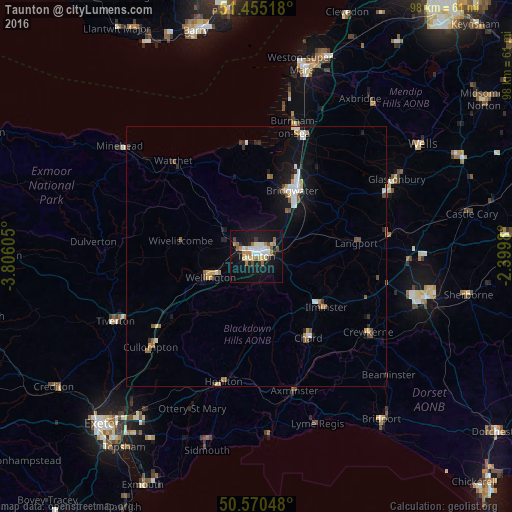
Analysis of Taunton night lights 2016
Square area 10x10 km:
 4.14%
4.14%90-99
5.21%80-89
4.14%70-79
2.54%60-69
4.28%50-59
2.27%40-49
1.87%30-39
1.34%20-29
2.54%10-19
33.82%0-9
37.83%Square area 50x50 km:
0.57%90-99
0.6%80-89
0.33%70-79
0.43%60-69
0.39%50-59
0.47%40-49
0.38%30-39
0.26%20-29
0.44%10-19
3.26%0-9
92.88%Clear (daylight) street map image can be seen on geolist.org.
Map coordinates:
51° 27' 18.6" North, 3° 48' 21.8" West
51° 0' 53.8" North, 3° 6' 10.5" West
50° 34' 13.7" North, 2° 23' 59.3" West
Some cities around Taunton sort by population:
• Bridgwater
14.4 km =8.9 mi,  28°
28°
• Burnham-on-Sea
25.9 km =16.1 mi,  16°
16°
• Chard
18.5 km =11.5 mi,  148°
148°
• Honiton
24.7 km =15.3 mi,  194°
194°
• Crewkerne
26 km =16.2 mi,  124°
124°
• Cullompton
27 km =16.8 mi,  228°
228°
• Ilminster
16.7 km =10.4 mi,  125°
125°
• Axminster
26.9 km =16.7 mi,  164°
164°
2636177 (p: 64,621)
Sources (retrieved 2019-11-25):
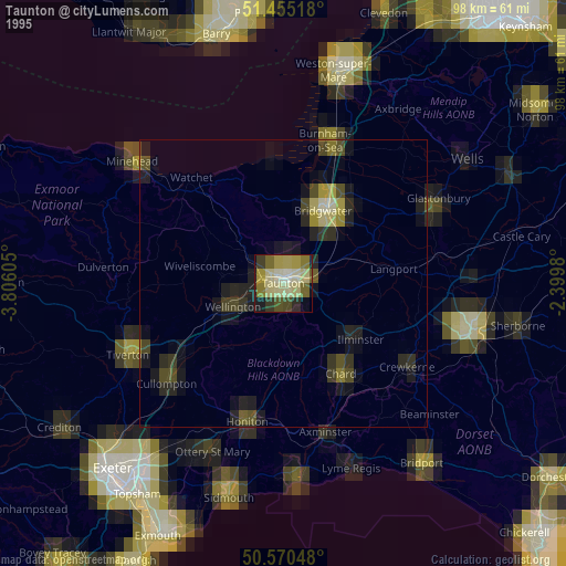
» NASA, Earths city lights 1995
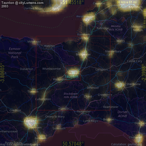
» NASA city lights 2003
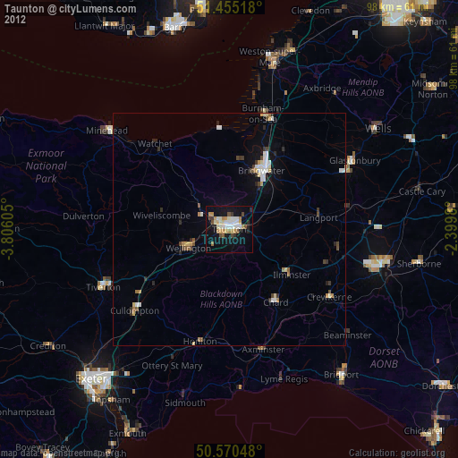
» Earth at Night: Flat Maps 2012, 2016