Barry night lights from space
Night Light of Barry (Wales) from space (United Kingdom) Src. Average luminocity for 10x10km area is 24.0434% and for 50x50km: 14.9976%.
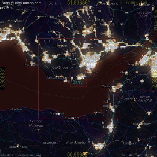
Analysis of Barry night lights 2016
Square area 10x10 km:
 3.92%
3.92%90-99
2.94%80-89
2.1%70-79
2.24%60-69
3.78%50-59
4.06%40-49
3.36%30-39
1.26%20-29
8.96%10-19
21.29%0-9
46.08%Square area 50x50 km:
2.9%90-99
3.27%80-89
1.13%70-79
1.49%60-69
1.29%50-59
1.21%40-49
1.77%30-39
2.33%20-29
5.65%10-19
10.03%0-9
68.94%Clear (daylight) street map image can be seen on geolist.org.
Map coordinates:
51° 50' 10.9" North, 3° 59' 12.9" West
51° 23' 59.2" North, 3° 17' 1.7" West
50° 57' 32.5" North, 2° 34' 50.4" West
Some cities around Barry sort by population:
• Cardiff
11.5 km =7.1 mi,  38°
38°
• Penarth
8.8 km =5.5 mi,  60°
60°
• Llantrisant
16.8 km =10.4 mi,  338°
338°
• Llantwit Major
14.1 km =8.8 mi,  274°
274°
• Beddau
17.9 km =11.1 mi, 343°
• Dinas Powys
6.2 km =3.9 mi,  51°
51°
• Rhoose
5.1 km =3.2 mi,  255°
255°
• Pontyclun
15.5 km =9.6 mi,  331°
331°
2656235 (p: 54,673)
Sources (retrieved 2019-11-25):
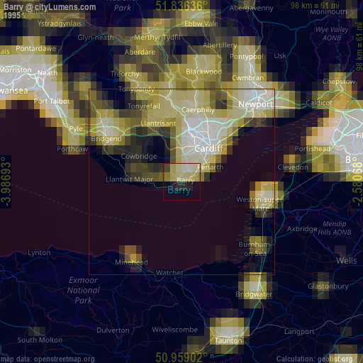
» NASA, Earths city lights 1995
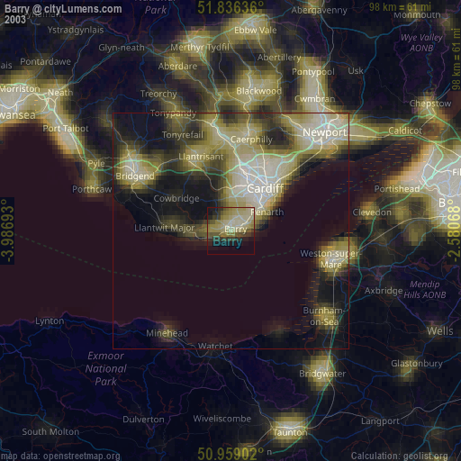
» NASA city lights 2003
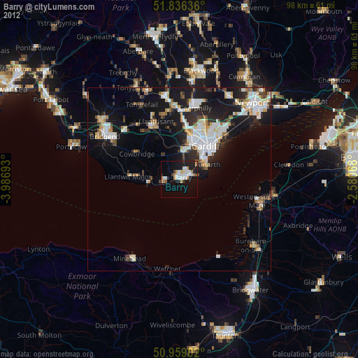
» Earth at Night: Flat Maps 2012, 2016