Marlow night lights from space
Night Light of Marlow (England) from space (United Kingdom) Src. Average luminocity for 10x10km area is 25.1698% and for 50x50km: 27.2299%.
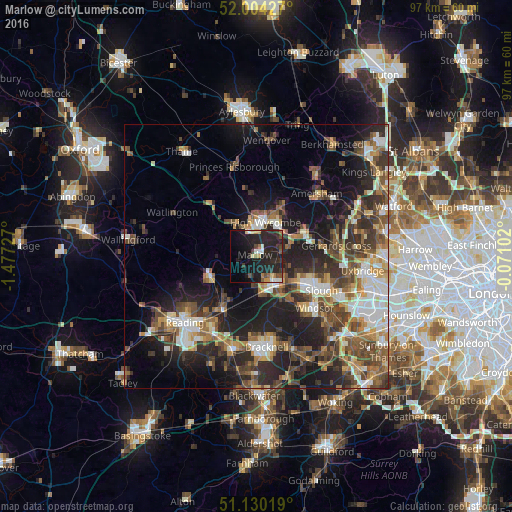
Analysis of Marlow night lights 2016
Square area 10x10 km:
 1.6%
1.6%90-99
3.21%80-89
2.14%70-79
2.81%60-69
2.94%50-59
2.27%40-49
2.14%30-39
3.88%20-29
23.93%10-19
30.08%0-9
25%Square area 50x50 km:
3.79%90-99
4.31%80-89
2.49%70-79
3.13%60-69
3.9%50-59
4.89%40-49
5.93%30-39
5.07%20-29
9.44%10-19
14.25%0-9
42.81%Clear (daylight) street map image can be seen on geolist.org.
Map coordinates:
52° 0' 15.4" North, 1° 28' 38.2" West
51° 34' 9.6" North, 0° 46' 26.9" West
51° 7' 48.7" North, 0° 4' 15.7" West
Some cities around Marlow sort by population:
• High Wycombe
6.9 km =4.3 mi,  14°
14°
• Maidenhead
6.4 km =4 mi,  144°
144°
• Beaconsfield
10 km =6.2 mi,  61°
61°
• Henley-on-Thames
9.6 km =6 mi,  245°
245°
• Twyford
12 km =7.5 mi,  209°
209°
• Farnham Royal
11.4 km =7.1 mi,  105°
105°
• Cookham
4.7 km =2.9 mi,  103°
103°
• Bourne End
4.3 km =2.7 mi,  79°
79°
2643003 (p: 18,261)
Sources (retrieved 2019-11-25):
» Earth at Night: Flat Maps 2012, 2016