Beaconsfield night lights from space
Night Light of Beaconsfield (England) from space (United Kingdom) Src. Average luminocity for 10x10km area is 27.361% and for 50x50km: 37.2721%.
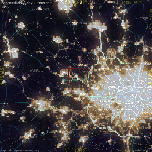
Analysis of Beaconsfield night lights 2016
Square area 10x10 km:
 1.47%
1.47%90-99
3.21%80-89
1.74%70-79
1.87%60-69
5.61%50-59
4.28%40-49
3.61%30-39
3.21%20-29
14.3%10-19
51.2%0-9
9.49%Square area 50x50 km:
7.47%90-99
8.31%80-89
3.66%70-79
3.88%60-69
5.07%50-59
5.75%40-49
5.84%30-39
5.39%20-29
8.93%10-19
13.59%0-9
32.1%Clear (daylight) street map image can be seen on geolist.org.
Map coordinates:
52° 2' 48.2" North, 1° 21' 1.6" West
51° 36' 43.9" North, 0° 38' 50.4" West
51° 10' 24.5" North, 0° 3' 20.9" East
Some cities around Beaconsfield sort by population:
• High Wycombe
7.3 km =4.5 mi,  284°
284°
• Amersham
6.4 km =4 mi,  19°
19°
• Gerrards Cross
7 km =4.3 mi,  114°
114°
• Chalfont Saint Peter
6.3 km =3.9 mi,  93°
93°
• Amersham on the Hill
7.5 km =4.7 mi, 21°
• Chalfont St Giles
5.8 km =3.6 mi,  67°
67°
• Cookham
7.2 km =4.5 mi,  215°
215°
• Bourne End
6 km =3.7 mi,  228°
228°
2656120 (p: 13,797)
Sources (retrieved 2019-11-25):
» Earth at Night: Flat Maps 2012, 2016