Mangotsfield night lights from space
Night Light of Mangotsfield (England) from space (United Kingdom) Src. Average luminocity for 10x10km area is 56.2112% and for 50x50km: 12.7826%.
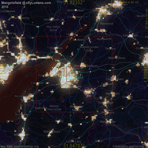
Analysis of Mangotsfield night lights 2016
Square area 10x10 km:
 12.97%
90-99
12.43%80-89
6.68%70-79
8.16%60-69
7.75%50-59
10.29%40-49
7.09%30-39
3.61%20-29
6.15%10-19
19.79%0-9
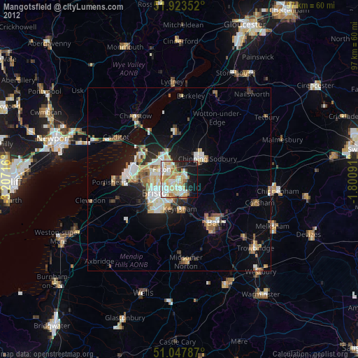
5.08%Square area 50x50 km:
1.99%90-99
2.38%80-89
1.19%70-79
1.33%60-69
1.47%50-59
2.01%40-49
1.8%30-39
1.72%20-29
3.32%10-19
6.69%0-9
76.09%Clear (daylight) street map image can be seen on geolist.org.
Map coordinates:
51° 55' 24.7" North, 3° 12' 25.8" West
51° 29' 16.1" North, 2° 30' 14.5" West
51° 2' 52.3" North, 1° 48' 3.3" West
Some cities around Mangotsfield sort by population:
• Bristol
7.4 km =4.6 mi,  240°
240°
• Kingswood
3.9 km =2.4 mi,  184°
184°
• Chipping Sodbury
9.5 km =5.9 mi,  53°
53°
• Yate
8.4 km =5.2 mi, 45°
• Keynsham
8.2 km =5.1 mi, 176°
• Stoke Gifford
4.1 km =2.5 mi,  321°
321°
• Bishopsworth
11.5 km =7.1 mi,  224°
224°
• Long Ashton
12.6 km =7.8 mi, 239°
2643116 (p: 36,427)
Sources (retrieved 2019-11-25):
» Earth at Night: Flat Maps 2012, 2016