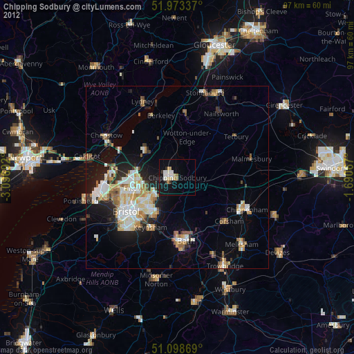
Chipping Sodbury night lights from space
Night Light of Chipping Sodbury (England) from space (United Kingdom) Src. Average luminocity for 10x10km area is 11.2861% and for 50x50km: 12.4827%.
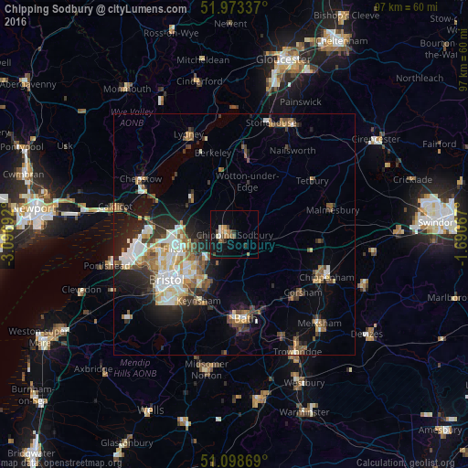
Analysis of Chipping Sodbury night lights 2016
Square area 10x10 km:
 0.53%
0.53%90-99
1.74%80-89
0.4%70-79
1.74%60-69
2.14%50-59
2.27%40-49
2.27%30-39
1.07%20-29
0.67%10-19
9.09%0-9
78.07%Square area 50x50 km:
2.02%90-99
2.29%80-89
1.13%70-79
1.33%60-69
1.6%50-59
1.95%40-49
1.65%30-39
1.74%20-29
3.37%10-19
6.05%0-9
76.87%Clear (daylight) street map image can be seen on geolist.org.
Map coordinates:
51° 58' 24.1" North, 3° 5' 48.9" West
51° 32' 17.3" North, 2° 23' 37.6" West
51° 5' 55.3" North, 1° 41' 26.4" West
Some cities around Chipping Sodbury sort by population:
• Kingswood
12.4 km =7.7 mi,  219°
219°
• Mangotsfield
9.5 km =5.9 mi,  233°
233°
• Yate
1.7 km =1.1 mi,  279°
279°
• Keynsham
15.6 km =9.7 mi,  207°
207°
• Dursley
16.2 km =10.1 mi,  9°
9°
• Stoke Gifford
10.4 km =6.5 mi,  256°
256°
• Thornbury
11.8 km =7.3 mi,  311°
311°
• Wotton-under-Edge
11 km =6.8 mi,  17°
17°
2653137 (p: 36,108)
Sources (retrieved 2019-11-25):
» Earth at Night: Flat Maps 2012, 2016