London night lights from space
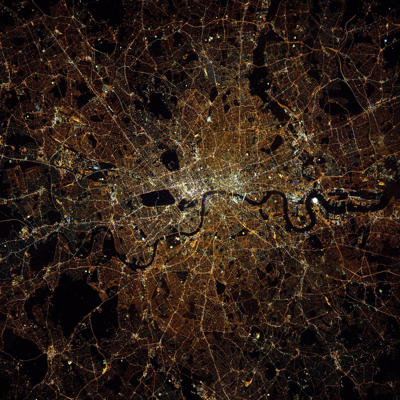
Night Light of London (England) from space (United Kingdom) Src. Average luminocity for 10x10km area is 99.9024% and for 50x50km: 70.7913%.
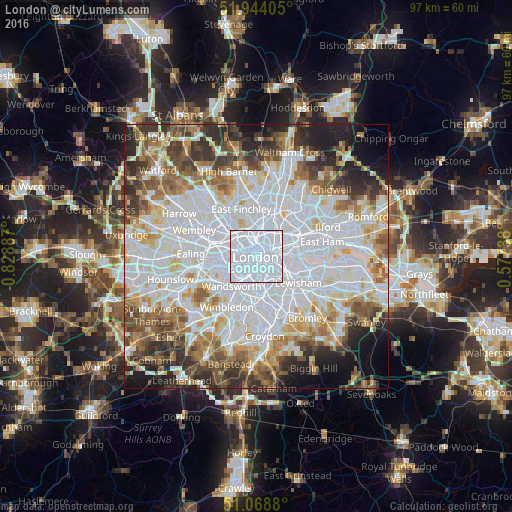
Analysis of London night lights 2016
Square area 10x10 km:
 91.44%
90-99
8.56%80-89
0%70-79
0%60-69
0%50-59
0%40-49
0%30-39
0%20-29
0%10-19
0%0-9
0%Square area 50x50 km:
28.84%90-99
17.25%80-89
6.87%70-79
5.68%60-69
6.7%50-59
6.58%40-49
5.64%30-39
5.98%20-29
6.75%10-19
5.62%0-9
4.09%Clear (daylight) street map image can be seen on geolist.org.
Map coordinates:
51° 56' 38.6" North, 0° 49' 43.9" West
51° 30' 30.7" North, 0° 7' 32.7" West
51° 4' 7.7" North, 0° 34' 38.6" East
Fantastic image of London from space taken by astronauts [src2], but I don't have information about it's orientation, scale or angle. If necessary, it was rotated manually, so North points approximately to upper direction. Click to zoom in:
Some cities around London sort by population:
• Islington
3.5 km =2.2 mi,  27°
27°
• City of Westminster
1.4 km =0.9 mi,  209°
209°
• Chelsea
3.8 km =2.4 mi,  232°
232°
• Camden Town
3.8 km =2.4 mi,  341°
341°
• West End of London
2.1 km =1.3 mi,  287°
287°
• Barnsbury
3.6 km =2.2 mi,  9°
9°
• City of London
2.4 km =1.5 mi,  78°
78°
• Lambeth
1.7 km =1.1 mi,  143°
143°
2643743 (p: 7,556,900)
Sources (retrieved 2019-11-25):
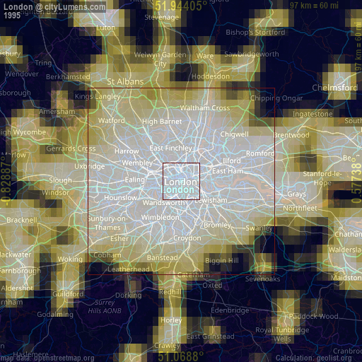
» NASA, Earths city lights 1995
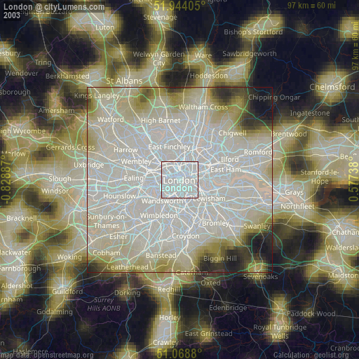
» NASA city lights 2003
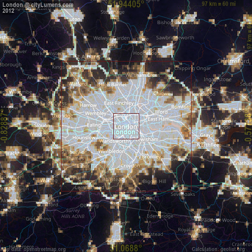
» Earth at Night: Flat Maps 2012, 2016
Src.2: Tim Kopra, Twitter/@astro_tim, 2016-04-06