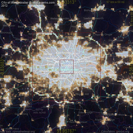
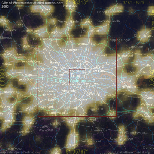
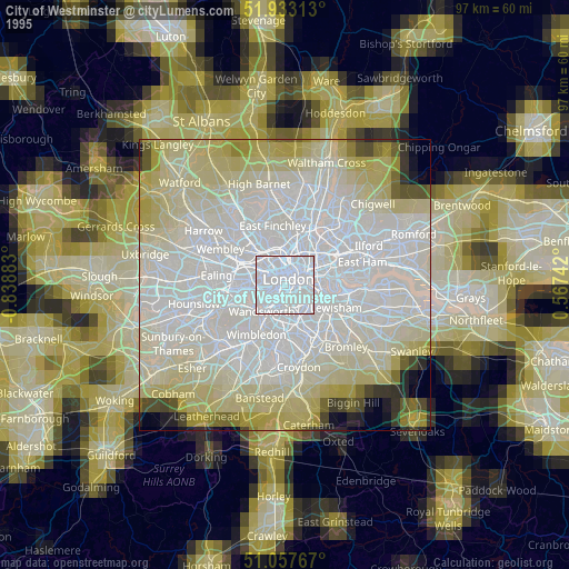
City of Westminster night lights from space
Night Light of City of Westminster (England) from space (United Kingdom) Src. Average luminocity for 10x10km area is 99.9131% and for 50x50km: 70.7165%.
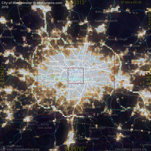
Analysis of City of Westminster night lights 2016
Square area 10x10 km:
 92.11%
90-99
7.89%80-89
0%70-79
0%60-69
0%50-59
0%40-49
0%30-39
0%20-29
0%10-19
0%0-9
0%Square area 50x50 km:
28.79%90-99
17.2%80-89
6.86%70-79
5.7%60-69
6.8%50-59
6.6%40-49
5.58%30-39
5.86%20-29
6.61%10-19
5.55%0-9
4.43%Clear (daylight) street map image can be seen on geolist.org.
Map coordinates:
51° 55' 59.3" North, 0° 50' 19.8" West
51° 29' 51" North, 0° 8' 8.5" West
51° 3' 27.6" North, 0° 34' 2.7" East
Some cities around City of Westminster sort by population:
• London
1.4 km =0.9 mi,  29°
29°
• Battersea
2.9 km =1.8 mi,  208°
208°
• Brixton
4.1 km =2.5 mi,  150°
150°
• Chelsea
2.6 km =1.6 mi,  244°
244°
• Camden Town
4.8 km =3 mi,  353°
353°
• Bayswater
3.7 km =2.3 mi,  294°
294°
• West End of London
2.3 km =1.4 mi,  324°
324°
• Lambeth
1.7 km =1.1 mi,  94°
94°
2634341 (p: 247,614)
Sources (retrieved 2019-11-25):
» NASA, Earths city lights 1995
» NASA city lights 2003
» Earth at Night: Flat Maps 2012, 2016