Islington night lights from space
Night Light of Islington (England) from space (United Kingdom) Src. Average luminocity for 10x10km area is 99.508% and for 50x50km: 70.5574%.
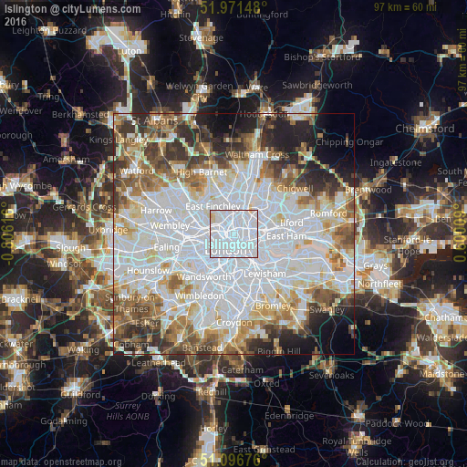
Analysis of Islington night lights 2016
Square area 10x10 km:
 89.17%
90-99
8.29%80-89
2.41%70-79
0.13%60-69
0%50-59
0%40-49
0%30-39
0%20-29
0%10-19
0%0-9
0%Square area 50x50 km:
28.78%90-99
17.22%80-89
6.93%70-79
5.65%60-69
6.77%50-59
6.83%40-49
5.38%30-39
5.54%20-29
6.44%10-19
5.61%0-9
4.84%Clear (daylight) street map image can be seen on geolist.org.
Map coordinates:
51° 58' 17.3" North, 0° 48' 22.2" West
51° 32' 10.4" North, 0° 6' 10.9" West
51° 5' 48.3" North, 0° 36' 0.3" East
Some cities around Islington sort by population:
• London
3.5 km =2.2 mi,  207°
207°
• Archway
4.1 km =2.5 mi,  328°
328°
• Holloway
2.4 km =1.5 mi,  319°
319°
• Camden Town
2.8 km =1.7 mi,  279°
279°
• Bethnal Green
3.1 km =1.9 mi,  109°
109°
• West End of London
4.4 km =2.7 mi,  235°
235°
• Barnsbury
1.1 km =0.7 mi,  297°
297°
• City of London
2.7 km =1.7 mi,  163°
163°
2646003 (p: 319,143)
Sources (retrieved 2019-11-25):
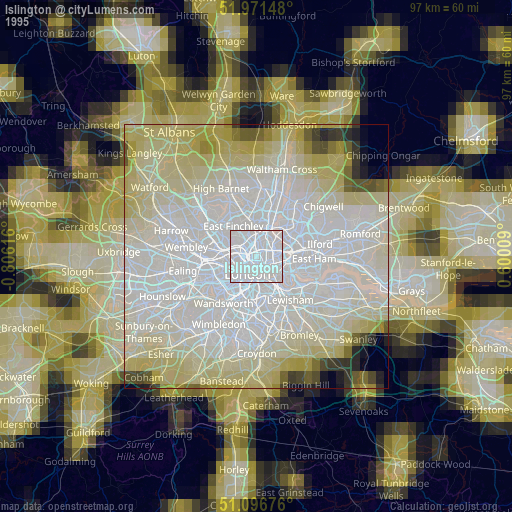
» NASA, Earths city lights 1995
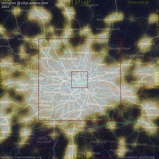
» NASA city lights 2003
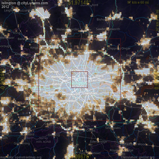
» Earth at Night: Flat Maps 2012, 2016