Camden Town night lights from space
Night Light of Camden Town (England) from space (United Kingdom) Src. Average luminocity for 10x10km area is 99.4131% and for 50x50km: 71.556%.
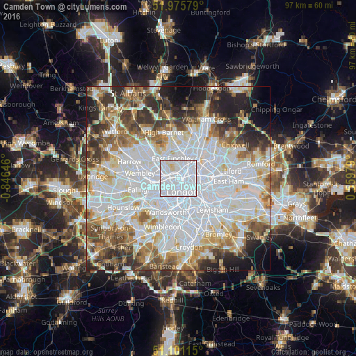
Analysis of Camden Town night lights 2016
Square area 10x10 km:
 82.35%
90-99
15.37%80-89
2.14%70-79
0.13%60-69
0%50-59
0%40-49
0%30-39
0%20-29
0%10-19
0%0-9
0%Square area 50x50 km:
28.97%90-99
17.46%80-89
7.06%70-79
5.77%60-69
7.07%50-59
6.71%40-49
5.52%30-39
5.9%20-29
6.89%10-19
5.62%0-9
3.03%Clear (daylight) street map image can be seen on geolist.org.
Map coordinates:
51° 58' 32.8" North, 0° 50' 47.3" West
51° 32' 26.1" North, 0° 8' 36" West
51° 6' 4.1" North, 0° 33' 35.2" East
Some cities around Camden Town sort by population:
• London
3.8 km =2.4 mi,  161°
161°
• Islington
2.8 km =1.7 mi,  99°
99°
• Archway
3 km =1.9 mi,  12°
12°
• Holloway
1.8 km =1.1 mi,  44°
44°
• Bayswater
4.3 km =2.7 mi,  220°
220°
• Belsize Park
2.2 km =1.4 mi,  291°
291°
• West End of London
3 km =1.9 mi,  195°
195°
• Barnsbury
1.8 km =1.1 mi,  89°
89°
3345437 (p: 26,122)
Sources (retrieved 2019-11-25):
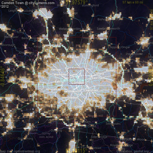
» Earth at Night: Flat Maps 2012, 2016