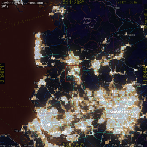
Leyland night lights from space
Night Light of Leyland (England) from space (United Kingdom) Src. Average luminocity for 10x10km area is 55.6275% and for 50x50km: 31.8136%.
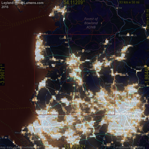
Analysis of Leyland night lights 2016
Square area 10x10 km:
 11.24%
90-99
12.88%80-89
3.79%70-79
7.2%60-69
13.76%50-59
6.31%40-49
7.58%30-39
4.29%20-29
18.43%10-19
10.23%0-9
4.29%Square area 50x50 km:
4.99%90-99
6.17%80-89
3.16%70-79
3.8%60-69
4.5%50-59
4.41%40-49
4.86%30-39
5.15%20-29
10.08%10-19
18.58%0-9
34.29%Clear (daylight) street map image can be seen on geolist.org.
Map coordinates:
54° 6' 43.5" North, 3° 23' 26.6" West
53° 41' 52.3" North, 2° 41' 15.3" West
53° 16' 46.3" North, 1° 59' 4.1" West
Some cities around Leyland sort by population:
• Preston
7.3 km =4.5 mi,  351°
351°
• Chorley
7.1 km =4.4 mi,  138°
138°
• Clayton-le-Woods
1.3 km =0.8 mi,  94°
94°
• Coppull
8.3 km =5.2 mi,  166°
166°
• Tarleton
9.6 km =6 mi,  258°
258°
• Freckleton
13.2 km =8.2 mi,  298°
298°
• Adlington
10.8 km =6.7 mi,  150°
150°
• Euxton
3.2 km =2 mi, 166°
2644547 (p: 37,614)
Sources (retrieved 2019-11-25):
» Earth at Night: Flat Maps 2012, 2016