Chorley night lights from space
Night Light of Chorley (England) from space (United Kingdom) Src. Average luminocity for 10x10km area is 34.6932% and for 50x50km: 38.5073%.
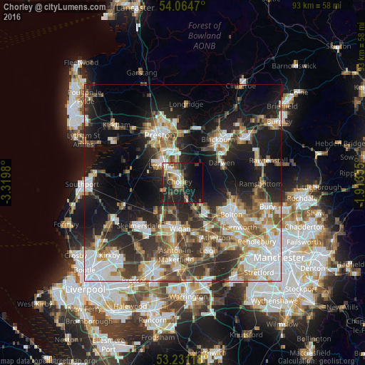
Analysis of Chorley night lights 2016
Square area 10x10 km:
 4.8%
4.8%90-99
6.44%80-89
2.15%70-79
3.16%60-69
6.19%50-59
3.79%40-49
6.94%30-39
4.04%20-29
19.07%10-19
25.76%0-9
17.68%Square area 50x50 km:
8.19%90-99
7.45%80-89
3.6%70-79
4.39%60-69
5.34%50-59
4.87%40-49
5.61%30-39
6.12%20-29
10.48%10-19
18.08%0-9
25.89%Clear (daylight) street map image can be seen on geolist.org.
Map coordinates:
54° 3' 52.9" North, 3° 19' 11.3" West
53° 39' 0" North, 2° 37' 0" West
53° 13' 52.2" North, 1° 54' 48.8" West
Some cities around Chorley sort by population:
• Leyland
7.1 km =4.4 mi,  318°
318°
• Horwich
7 km =4.3 mi,  140°
140°
• Clayton-le-Woods
6.2 km =3.9 mi,  326°
326°
• Coppull
3.9 km =2.4 mi,  225°
225°
• Adlington
4.1 km =2.5 mi,  170°
170°
• Euxton
4.5 km =2.8 mi,  299°
299°
• Shevington
10 km =6.2 mi,  210°
210°
• Blackrod
6.9 km =4.3 mi,  159°
159°
2653086 (p: 33,888)
Sources (retrieved 2019-11-25):
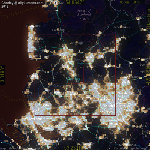
» Earth at Night: Flat Maps 2012, 2016