Leven night lights from space
Night Light of Leven (Scotland) from space (United Kingdom) Src. Average luminocity for 10x10km area is 13.4282% and for 50x50km: 5.4944%.
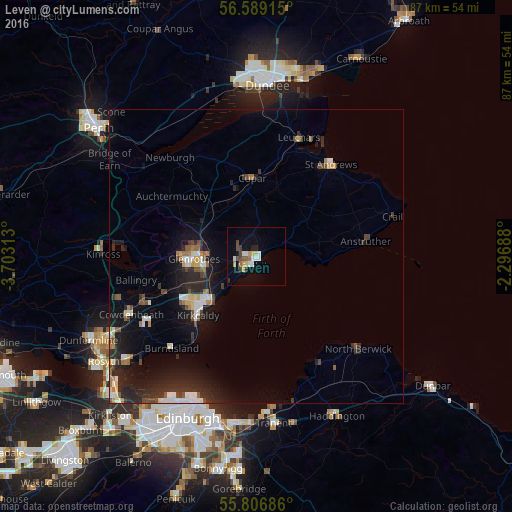
Analysis of Leven night lights 2016
Square area 10x10 km:
 2.51%
2.51%90-99
1.79%80-89
1.44%70-79
1.44%60-69
1.44%50-59
0.96%40-49
2.51%30-39
0.96%20-29
1.79%10-19
5.5%0-9
79.67%Square area 50x50 km:
0.68%90-99
0.85%80-89
0.43%70-79
0.34%60-69
0.66%50-59
0.49%40-49
0.81%30-39
0.65%20-29
2.6%10-19
4.83%0-9
87.65%Clear (daylight) street map image can be seen on geolist.org.
Map coordinates:
56° 35' 20.9" North, 3° 42' 11.3" West
56° 12' 0" North, 3° 0' 0" West
55° 48' 24.7" North, 2° 17' 48.8" West
Some cities around Leven sort by population:
• Kirkcaldy
13.6 km =8.5 mi,  226°
226°
• Glenrothes
10.7 km =6.6 mi,  267°
267°
• Saint Andrews
19.8 km =12.3 mi,  38°
38°
• Methil
2.1 km =1.3 mi,  219°
219°
• Cupar
13.2 km =8.2 mi,  356°
356°
• Lochgelly
20.8 km =12.9 mi,  247°
247°
• Burntisland
21.5 km =13.4 mi, 223°
• Ballingry
20.7 km =12.9 mi,  258°
258°
2644577 (p: 8,960)
Sources (retrieved 2019-11-25):
» Earth at Night: Flat Maps 2012, 2016