Leeds night lights from space
Night Light of Leeds (England) from space (United Kingdom) Src. Average luminocity for 10x10km area is 97.3148% and for 50x50km: 38.4619%.
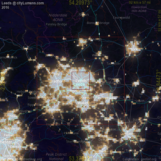
Analysis of Leeds night lights 2016
Square area 10x10 km:
 59.66%
90-99
31.35%80-89
3.84%70-79
3.84%60-69
0.93%50-59
0.4%40-49
0%30-39
0%20-29
0%10-19
0%0-9
0%Square area 50x50 km:
9.98%90-99
8.84%80-89
3.25%70-79
3.93%60-69
4.64%50-59
4.62%40-49
4.46%30-39
5.62%20-29
8.82%10-19
11.65%0-9
34.19%Clear (daylight) street map image can be seen on geolist.org.
Map coordinates:
54° 12' 35" North, 2° 15' 3.5" West
53° 47' 47.3" North, 1° 32' 52.3" West
53° 22' 44.8" North, 0° 50' 41" West
Some cities around Leeds sort by population:
• Morley
7.1 km =4.4 mi,  208°
208°
• Batley
11.8 km =7.3 mi, 208°
• Pudsey
7.5 km =4.7 mi,  269°
269°
• Lofthouse
8.2 km =5.1 mi,  155°
155°
• Horsforth
7.8 km =4.8 mi,  311°
311°
• Chapel Allerton
3.7 km =2.3 mi,  9°
9°
• Garforth
11 km =6.8 mi,  92°
92°
• Holbeck
1.9 km =1.2 mi,  222°
222°
2644688 (p: 455,123)
Sources (retrieved 2019-11-25):
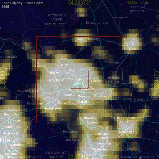
» NASA, Earths city lights 1995
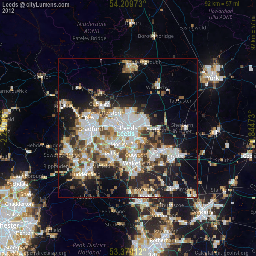
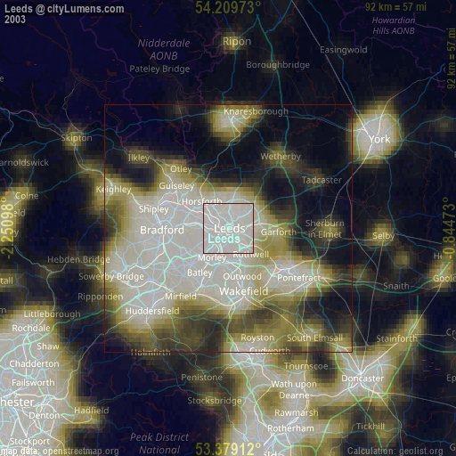
» NASA city lights 2003
» Earth at Night: Flat Maps 2012, 2016