Morley night lights from space
Night Light of Morley (England) from space (United Kingdom) Src. Average luminocity for 10x10km area is 86.6477% and for 50x50km: 40.0631%.
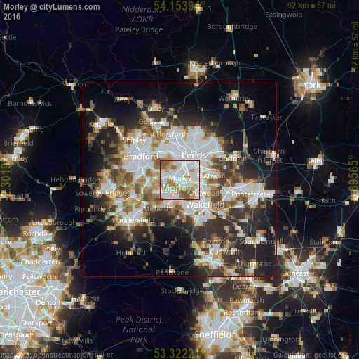
Analysis of Morley night lights 2016
Square area 10x10 km:
 33.33%
90-99
26.64%80-89
7.07%70-79
14.65%60-69
8.46%50-59
8.46%40-49
1.39%30-39
0%20-29
0%10-19
0%0-9
0%Square area 50x50 km:
10.11%90-99
8.93%80-89
3.32%70-79
4.32%60-69
4.73%50-59
4.92%40-49
4.6%30-39
6.44%20-29
10.15%10-19
12.89%0-9
29.59%Clear (daylight) street map image can be seen on geolist.org.
Map coordinates:
54° 9' 14.2" North, 2° 18' 6.8" West
53° 44' 24.5" North, 1° 35' 55.6" West
53° 19' 20" North, 0° 53' 44.3" West
Some cities around Morley sort by population:
• Leeds
7.1 km =4.4 mi,  28°
28°
• Dewsbury
5.8 km =3.6 mi,  199°
199°
• Batley
4.7 km =2.9 mi,  209°
209°
• Lofthouse
6.8 km =4.2 mi,  100°
100°
• Ossett
6.8 km =4.2 mi,  169°
169°
• Liversedge
7.3 km =4.5 mi,  237°
237°
• Heckmondwike
6.4 km =4 mi,  234°
234°
• Holbeck
5.2 km =3.2 mi,  22°
22°
2642189 (p: 57,385)
Sources (retrieved 2019-11-25):
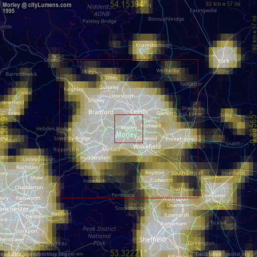
» NASA, Earths city lights 1995
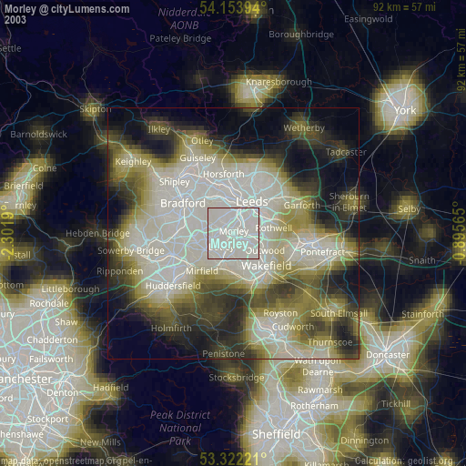
» NASA city lights 2003
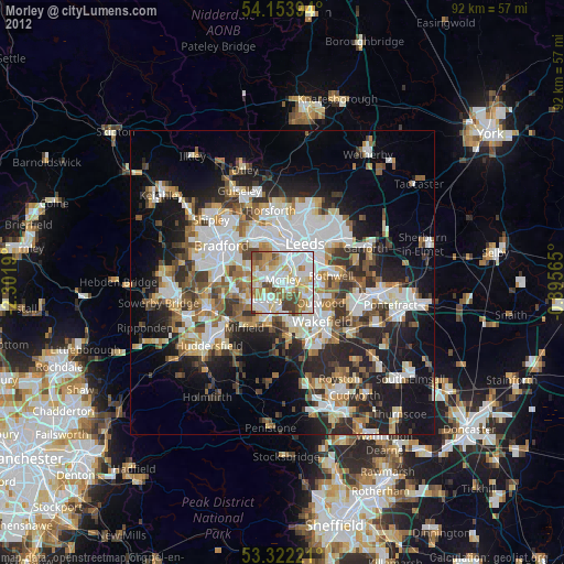
» Earth at Night: Flat Maps 2012, 2016