Batley night lights from space
Night Light of Batley (England) from space (United Kingdom) Src. Average luminocity for 10x10km area is 75.6818% and for 50x50km: 40.7578%.
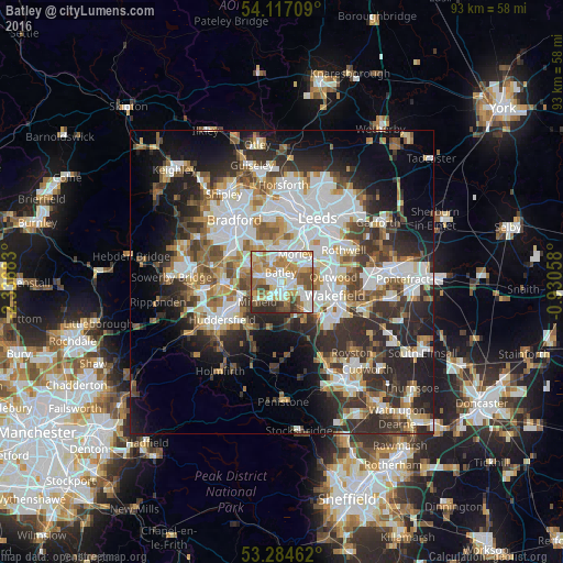
Analysis of Batley night lights 2016
Square area 10x10 km:
 19.44%
90-99
21.21%80-89
7.07%70-79
15.78%60-69
11.99%50-59
8.33%40-49
6.57%30-39
5.56%20-29
4.04%10-19
0%0-9
0%Square area 50x50 km:
10.18%90-99
9.04%80-89
3.61%70-79
4.33%60-69
4.8%50-59
5.07%40-49
4.87%30-39
6.87%20-29
11%10-19
11.4%0-9
28.84%Clear (daylight) street map image can be seen on geolist.org.
Map coordinates:
54° 7' 1.5" North, 2° 20' 12.6" West
53° 42' 10.5" North, 1° 38' 1.3" West
53° 17' 4.6" North, 0° 55' 50.1" West
Some cities around Batley sort by population:
• Morley
4.7 km =2.9 mi,  29°
29°
• Dewsbury
1.4 km =0.9 mi,  167°
167°
• Cleckheaton
5.7 km =3.5 mi,  294°
294°
• Ossett
4.4 km =2.7 mi,  126°
126°
• Mirfield
5.3 km =3.3 mi,  231°
231°
• Liversedge
3.9 km =2.4 mi,  273°
273°
• Heckmondwike
2.9 km =1.8 mi,  277°
277°
• Horbury
6.8 km =4.2 mi, 134°
2656168 (p: 50,807)
Sources (retrieved 2019-11-25):
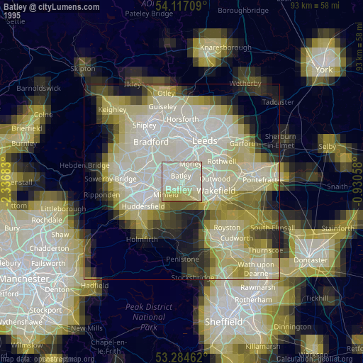
» NASA, Earths city lights 1995
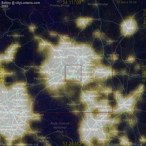
» NASA city lights 2003
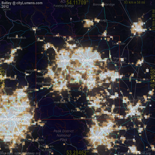
» Earth at Night: Flat Maps 2012, 2016