Lofthouse night lights from space
Night Light of Lofthouse (England) from space (United Kingdom) Src. Average luminocity for 10x10km area is 79.423% and for 50x50km: 40.7578%.
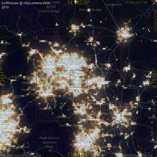
Analysis of Lofthouse night lights 2016
Square area 10x10 km:
 27.27%
90-99
23.11%80-89
8.71%70-79
6.82%60-69
8.46%50-59
8.84%40-49
10.1%30-39
6.69%20-29
0%10-19
0%0-9
0%Square area 50x50 km:
10.44%90-99
9.28%80-89
3.42%70-79
4.36%60-69
4.81%50-59
4.91%40-49
4.72%30-39
6.43%20-29
10.29%10-19
11.38%0-9
29.96%Clear (daylight) street map image can be seen on geolist.org.
Map coordinates:
54° 8' 36.2" North, 2° 12' 0.4" West
53° 43' 46.1" North, 1° 29' 49.1" West
53° 18' 41.2" North, 0° 47' 37.9" West
Some cities around Lofthouse sort by population:
• Leeds
8.2 km =5.1 mi,  335°
335°
• Wakefield
5.1 km =3.2 mi,  180°
180°
• Castleford
8.9 km =5.5 mi,  92°
92°
• Morley
6.8 km =4.2 mi,  280°
280°
• Ossett
7.8 km =4.8 mi,  224°
224°
• Kippax
9.3 km =5.8 mi,  63°
63°
• Horbury
8.7 km =5.4 mi,  208°
208°
• Holbeck
7.6 km =4.7 mi,  322°
322°
2643776 (p: 23,458)
Sources (retrieved 2019-11-25):
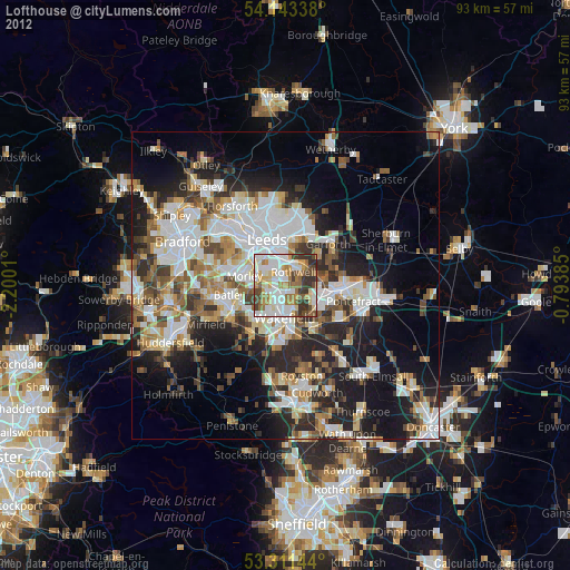
» Earth at Night: Flat Maps 2012, 2016