Ledbury night lights from space
Night Light of Ledbury (England) from space (United Kingdom) Src. Average luminocity for 10x10km area is 2.4583% and for 50x50km: 7.4693%.
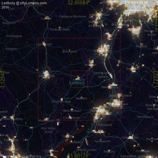
Analysis of Ledbury night lights 2016
Square area 10x10 km:
 0%
0%90-99
0.13%80-89
0.38%70-79
0.51%60-69
0.88%50-59
0.63%40-49
1.01%30-39
0%20-29
0%10-19
0%0-9
96.46%Square area 50x50 km:
0.8%90-99
1.17%80-89
0.78%70-79
0.95%60-69
1.13%50-59
1.09%40-49
1.07%30-39
0.72%20-29
1.82%10-19
6.53%0-9
83.95%Clear (daylight) street map image can be seen on geolist.org.
Map coordinates:
52° 28' 0.6" North, 3° 7' 46.1" West
52° 2' 11" North, 2° 25' 34.9" West
51° 36' 6.3" North, 1° 43' 23.6" West
Some cities around Ledbury sort by population:
• Gloucester
22.8 km =14.2 mi,  146°
146°
• Worcester
22.1 km =13.7 mi,  39°
39°
• Hereford
19.9 km =12.4 mi,  276°
276°
• Great Malvern
10.9 km =6.8 mi, 39°
• Tewkesbury
18.9 km =11.7 mi,  105°
105°
• Churchdown
24.9 km =15.5 mi,  135°
135°
• Cinderford
24.1 km =15 mi,  191°
191°
• Ross on Wye
16.4 km =10.2 mi,  215°
215°
2644707 (p: 8,862)
Sources (retrieved 2019-11-25):
» Earth at Night: Flat Maps 2012, 2016