Great Malvern night lights from space
Night Light of Great Malvern (England) from space (United Kingdom) Src. Average luminocity for 10x10km area is 9.0899% and for 50x50km: 5.9576%.
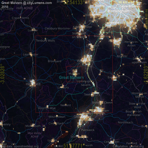
Analysis of Great Malvern night lights 2016
Square area 10x10 km:
 0.13%
0.13%90-99
0.79%80-89
0.93%70-79
1.32%60-69
1.59%50-59
3.17%40-49
0.66%30-39
1.46%20-29
1.46%10-19
1.98%0-9
86.51%Square area 50x50 km:
0.57%90-99
0.88%80-89
0.46%70-79
0.7%60-69
0.88%50-59
0.82%40-49
0.83%30-39
0.58%20-29
1.19%10-19
6.2%0-9
86.89%Clear (daylight) street map image can be seen on geolist.org.
Map coordinates:
52° 32' 28.8" North, 3° 1' 41.8" West
52° 6' 41.8" North, 2° 19' 30.5" West
51° 40' 39.8" North, 1° 37' 19.3" West
Some cities around Great Malvern sort by population:
• Worcester
11.2 km =7 mi,  39°
39°
• Droitwich
21 km =13 mi,  34°
34°
• Evesham
25.8 km =16 mi,  94°
94°
• Stourport-on-Severn
25.6 km =15.9 mi,  6°
6°
• Tewkesbury
17.4 km =10.8 mi,  139°
139°
• Bishops Cleeve
25.6 km =15.9 mi, 135°
• Ledbury
10.9 km =6.8 mi,  219°
219°
• Pershore
17 km =10.6 mi, 89°
2648063 (p: 36,770)
Sources (retrieved 2019-11-25):
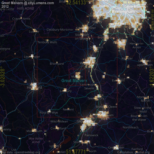
» Earth at Night: Flat Maps 2012, 2016