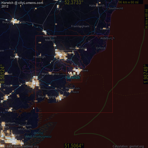
Harwich night lights from space
Night Light of Harwich (England) from space (United Kingdom) Src. Average luminocity for 10x10km area is 24.0227% and for 50x50km: 4.9362%.
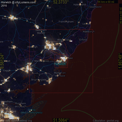
Analysis of Harwich night lights 2016
Square area 10x10 km:
 4.67%
4.67%90-99
5.93%80-89
1.52%70-79
1.64%60-69
2.65%50-59
1.77%40-49
1.64%30-39
3.41%20-29
3.91%10-19
26.64%0-9
46.21%Square area 50x50 km:
0.59%90-99
0.66%80-89
0.34%70-79
0.53%60-69
0.63%50-59
0.69%40-49
0.86%30-39
0.78%20-29
1.04%10-19
4.46%0-9
89.41%Clear (daylight) street map image can be seen on geolist.org.
Map coordinates:
52° 22' 23.9" North, 0° 34' 52.5" East
51° 56' 31" North, 1° 17' 3.7" East
51° 30' 23" North, 1° 59' 15" East
Some cities around Harwich sort by population:
• Ipswich
15.7 km =9.8 mi,  325°
325°
• Clacton-on-Sea
19.1 km =11.9 mi,  207°
207°
• Felixstowe
5.2 km =3.2 mi,  62°
62°
• Walton-on-the-Naze
10.5 km =6.5 mi,  186°
186°
• Frinton-on-Sea
12.7 km =7.9 mi, 192°
• Woodbridge
17 km =10.6 mi,  8°
8°
• Kesgrave
13.8 km =8.6 mi,  346°
346°
• Manningtree
15.3 km =9.5 mi,  271°
271°
2647383 (p: 20,723)
Sources (retrieved 2019-11-25):
» Earth at Night: Flat Maps 2012, 2016