Horwich night lights from space
Night Light of Horwich (England) from space (United Kingdom) Src. Average luminocity for 10x10km area is 32.5657% and for 50x50km: 47.1926%.
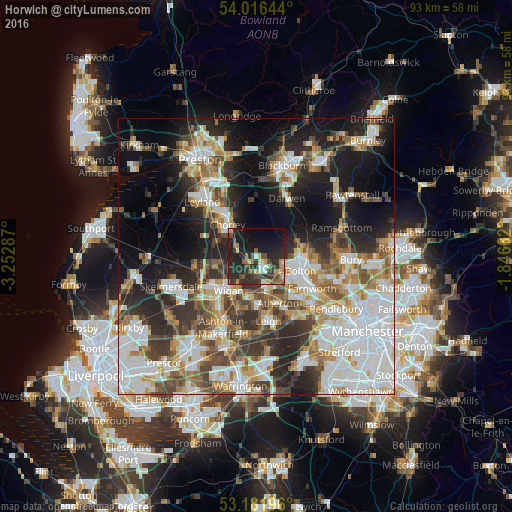
Analysis of Horwich night lights 2016
Square area 10x10 km:
 2.02%
2.02%90-99
3.79%80-89
3.03%70-79
3.03%60-69
4.04%50-59
5.43%40-49
8.59%30-39
7.45%20-29
22.47%10-19
28.79%0-9
11.36%Square area 50x50 km:
12.01%90-99
10.47%80-89
4.24%70-79
5.11%60-69
6.33%50-59
5.47%40-49
6.32%30-39
6.3%20-29
10.54%10-19
15.83%0-9
17.37%Clear (daylight) street map image can be seen on geolist.org.
Map coordinates:
54° 0' 59.2" North, 3° 15' 10.3" West
53° 36' 4.5" North, 2° 32' 59.1" West
53° 10' 55.1" North, 1° 50' 47.8" West
Some cities around Horwich sort by population:
• Wigan
8.7 km =5.4 mi,  221°
221°
• Bolton
7.9 km =4.9 mi,  104°
104°
• Chorley
7 km =4.3 mi,  320°
320°
• Westhoughton
6 km =3.7 mi,  164°
164°
• Hindley
7.9 km =4.9 mi,  196°
196°
• Coppull
7.7 km =4.8 mi,  290°
290°
• Adlington
4 km =2.5 mi, 289°
• Blackrod
2.2 km =1.4 mi,  243°
243°
2646542 (p: 18,696)
Sources (retrieved 2019-11-25):
» Earth at Night: Flat Maps 2012, 2016