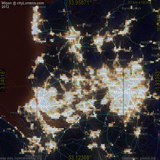
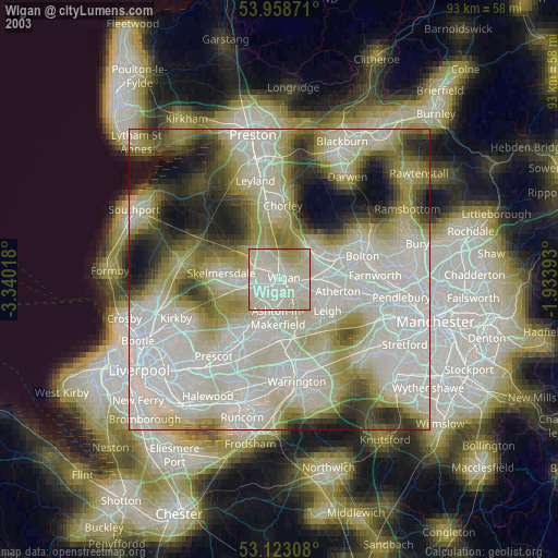
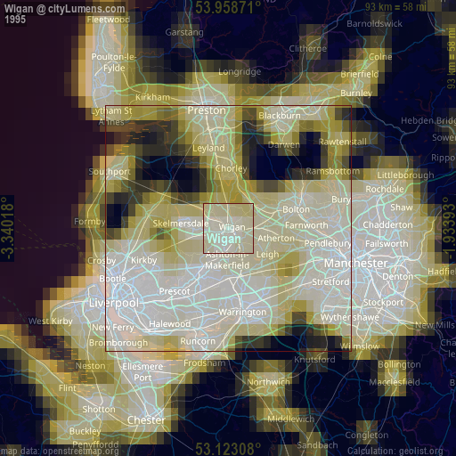
Wigan night lights from space
Night Light of Wigan (England) from space (United Kingdom) Src. Average luminocity for 10x10km area is 57.9484% and for 50x50km: 48.8253%.
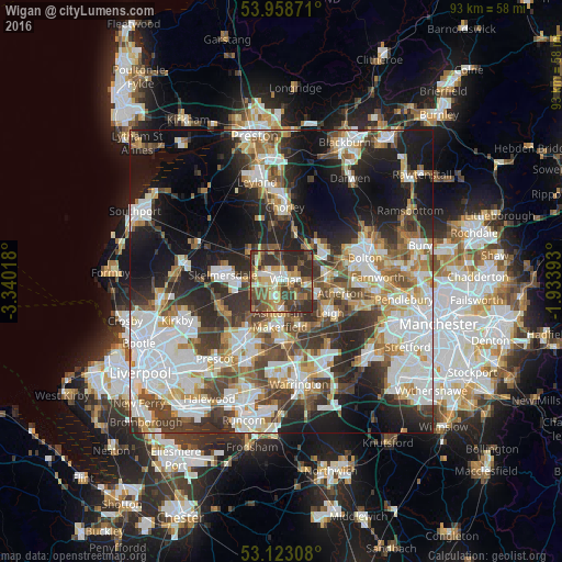
Analysis of Wigan night lights 2016
Square area 10x10 km:
 5.42%
5.42%90-99
11.38%80-89
8.2%70-79
9.92%60-69
8.33%50-59
10.05%40-49
16.53%30-39
15.48%20-29
14.68%10-19
0%0-9
0%Square area 50x50 km:
12.27%90-99
11.17%80-89
4.57%70-79
4.89%60-69
6.03%50-59
5.37%40-49
7.08%30-39
7.5%20-29
11.05%10-19
16.5%0-9
13.54%Clear (daylight) street map image can be seen on geolist.org.
Map coordinates:
53° 57' 31.4" North, 3° 20' 24.6" West
53° 32' 34.7" North, 2° 38' 13.4" West
53° 7' 23.1" North, 1° 56' 2.1" West
Some cities around Wigan sort by population:
• Ashton in Makerfield
6.7 km =4.2 mi,  187°
187°
• Hindley
3.7 km =2.3 mi,  106°
106°
• Ince-in-Makerfield
1.7 km =1.1 mi,  128°
128°
• Abram
4.8 km =3 mi,  142°
142°
• Billinge
6.9 km =4.3 mi,  223°
223°
• Appley Bridge
6.8 km =4.2 mi,  304°
304°
• Shevington
4.9 km =3 mi,  311°
311°
• Blackrod
6.6 km =4.1 mi,  34°
34°
2633948 (p: 175,405)
Sources (retrieved 2019-11-25):
» NASA, Earths city lights 1995
» NASA city lights 2003
» Earth at Night: Flat Maps 2012, 2016