Hook night lights from space
Night Light of Hook (England) from space (United Kingdom) Src. Average luminocity for 10x10km area is 4.7465% and for 50x50km: 15.1501%.
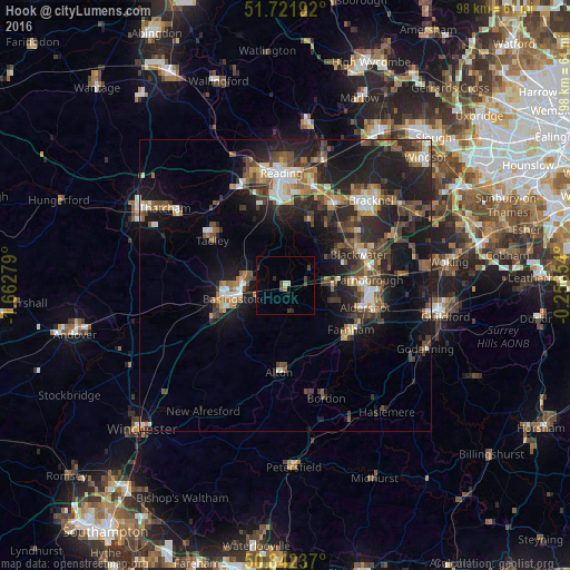
Analysis of Hook night lights 2016
Square area 10x10 km:
 0%
0%90-99
0.14%80-89
0.98%70-79
0%60-69
0.56%50-59
0%40-49
2.1%30-39
1.4%20-29
2.1%10-19
0.42%0-9
92.3%Square area 50x50 km:
1.51%90-99
2.05%80-89
1.04%70-79
1.61%60-69
2.11%50-59
2.55%40-49
3.44%30-39
3.02%20-29
6.08%10-19
12.9%0-9
63.69%Clear (daylight) street map image can be seen on geolist.org.
Map coordinates:
51° 43' 18.9" North, 1° 39' 46" West
51° 17' 3.3" North, 0° 57' 34.8" West
50° 50' 32.5" North, 0° 15' 23.5" West
Some cities around Hook sort by population:
• Basingstoke
9.2 km =5.7 mi,  254°
254°
• Aldershot
14.2 km =8.8 mi,  106°
106°
• Farnborough
14.2 km =8.8 mi,  85°
85°
• Fleet
8.8 km =5.5 mi, 90°
• Farnham
13.5 km =8.4 mi,  125°
125°
• Yateley
11.1 km =6.9 mi,  54°
54°
• Tadley
13.9 km =8.6 mi,  302°
302°
• Hale
13.3 km =8.3 mi,  117°
117°
2646654 (p: 7,321)
Sources (retrieved 2019-11-25):
» Earth at Night: Flat Maps 2012, 2016