Tadley night lights from space
Night Light of Tadley (England) from space (United Kingdom) Src. Average luminocity for 10x10km area is 9.2675% and for 50x50km: 10.803%.
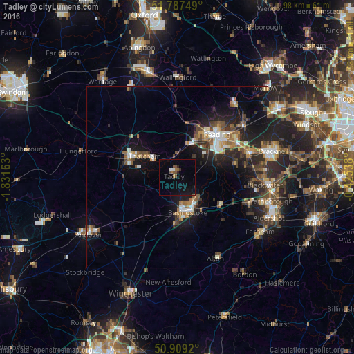
Analysis of Tadley night lights 2016
Square area 10x10 km:
 0.56%
0.56%90-99
1.12%80-89
0%70-79
0%60-69
1.82%50-59
1.54%40-49
2.24%30-39
0.56%20-29
1.12%10-19
7.42%0-9
83.61%Square area 50x50 km:
1.14%90-99
1.53%80-89
0.78%70-79
1.05%60-69
1.83%50-59
1.52%40-49
2.08%30-39
1.89%20-29
3.64%10-19
8.51%0-9
76.01%Clear (daylight) street map image can be seen on geolist.org.
Map coordinates:
51° 47' 15" North, 1° 49' 53.9" West
51° 21' 1.6" North, 1° 7' 42.6" West
50° 54' 33.1" North, 0° 25' 31.4" West
Some cities around Tadley sort by population:
• Reading
16 km =9.9 mi,  42°
42°
• Basingstoke
10.2 km =6.3 mi,  163°
163°
• Newbury
14.8 km =9.2 mi,  292°
292°
• Lower Earley
16.8 km =10.4 mi,  59°
59°
• Thatcham
10.9 km =6.8 mi,  302°
302°
• Yateley
20.8 km =12.9 mi,  92°
92°
• Calcot
11.4 km =7.1 mi,  28°
28°
• Hook
13.9 km =8.6 mi,  122°
122°
2636333 (p: 15,836)
Sources (retrieved 2019-11-25):
» Earth at Night: Flat Maps 2012, 2016