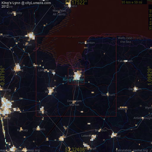
King's Lynn night lights from space
Night Light of King's Lynn (England) from space (United Kingdom) Src. Average luminocity for 10x10km area is 23.5139% and for 50x50km: 2.6048%.
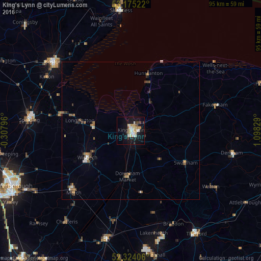
Analysis of King's Lynn night lights 2016
Square area 10x10 km:
 3.16%
3.16%90-99
5.93%80-89
3.91%70-79
2.9%60-69
1.01%50-59
1.26%40-49
2.15%30-39
1.89%20-29
1.14%10-19
29.67%0-9
46.97%Square area 50x50 km:
0.23%90-99
0.42%80-89
0.25%70-79
0.33%60-69
0.29%50-59
0.38%40-49
0.46%30-39
0.4%20-29
0.37%10-19
1.57%0-9
95.3%Clear (daylight) street map image can be seen on geolist.org.
Map coordinates:
53° 10' 30.8" North, 0° 18' 28.7" West
52° 45' 6.2" North, 0° 23' 42.6" East
52° 19' 26.6" North, 1° 5' 53.8" East
Some cities around King's Lynn sort by population:
• Wisbech
18.5 km =11.5 mi,  239°
239°
• March
30.4 km =18.9 mi,  222°
222°
• Downham Market
16.1 km =10 mi,  182°
182°
• Hunstanton
23.1 km =14.4 mi,  17°
17°
• Fakenham
31.6 km =19.6 mi,  74°
74°
• Littleport
33.2 km =20.6 mi,  190°
190°
• Holbeach
26.3 km =16.3 mi,  282°
282°
• Swaffham
22.7 km =14.1 mi,  120°
120°
2645456 (p: 46,093)
Sources (retrieved 2019-11-25):
» Earth at Night: Flat Maps 2012, 2016