Hirwaun night lights from space
Night Light of Hirwaun (Wales) from space (United Kingdom) Src. Average luminocity for 10x10km area is 4.2213% and for 50x50km: 11.8383%.
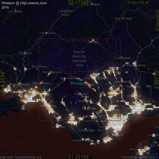
Analysis of Hirwaun night lights 2016
Square area 10x10 km:
 0%
0%90-99
0%80-89
0.28%70-79
0.84%60-69
0%50-59
0%40-49
1.26%30-39
3.22%20-29
1.68%10-19
2.1%0-9
90.62%Square area 50x50 km:
1.12%90-99
1.58%80-89
1.13%70-79
1.64%60-69
1.49%50-59
1.55%40-49
1.62%30-39
2.16%20-29
4.1%10-19
12.49%0-9
71.12%Clear (daylight) street map image can be seen on geolist.org.
Map coordinates:
52° 10' 20.9" North, 4° 12' 48.2" West
51° 44' 21" North, 3° 30' 37" West
51° 18' 6" North, 2° 48' 25.7" West
Some cities around Hirwaun sort by population:
• Rhondda
9.9 km =6.2 mi,  154°
154°
• Merthyr Tydfil
9.2 km =5.7 mi,  83°
83°
• Aberdare
5 km =3.1 mi,  123°
123°
• Treorchy
8.9 km =5.5 mi,  178°
178°
• Ferndale
9.8 km =6.1 mi, 153°
• Pentre
9.5 km =5.9 mi,  172°
172°
• Glyn-neath
7.5 km =4.7 mi,  277°
277°
• Abercanaid
10.1 km =6.3 mi,  99°
99°
2646830 (p: 7,247)
Sources (retrieved 2019-11-25):
» Earth at Night: Flat Maps 2012, 2016