Rhondda night lights from space
Night Light of Rhondda (Wales) from space (United Kingdom) Src. Average luminocity for 10x10km area is 10.0994% and for 50x50km: 16.4829%.
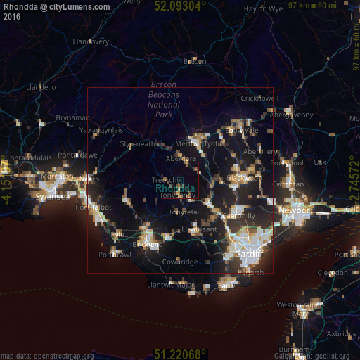
Analysis of Rhondda night lights 2016
Square area 10x10 km:
 0%
0%90-99
0%80-89
0.7%70-79
0.42%60-69
1.96%50-59
4.34%40-49
1.82%30-39
2.52%20-29
1.96%10-19
1.96%0-9
84.31%Square area 50x50 km:
2.42%90-99
2.96%80-89
1.34%70-79
1.84%60-69
1.78%50-59
1.82%40-49
2.13%30-39
2.67%20-29
5.24%10-19
14.84%0-9
62.96%Clear (daylight) street map image can be seen on geolist.org.
Map coordinates:
52° 5' 34.9" North, 4° 9' 7.1" West
51° 39' 32.3" North, 3° 26' 55.9" West
51° 13' 14.4" North, 2° 44' 44.6" West
Some cities around Rhondda sort by population:
• Tonypandy
4.1 km =2.5 mi,  186°
186°
• Aberdare
6.2 km =3.9 mi,  359°
359°
• Mountain Ash
5.5 km =3.4 mi,  59°
59°
• Tonyrefail
8.4 km =5.2 mi,  171°
171°
• Treorchy
3.9 km =2.4 mi,  271°
271°
• Ferndale
0.2 km =0.1 mi,  27°
27°
• Abercynon
8.5 km =5.3 mi,  100°
100°
• Pentre
3 km =1.9 mi,  259°
259°
2639447 (p: 59,450)
Sources (retrieved 2019-11-25):
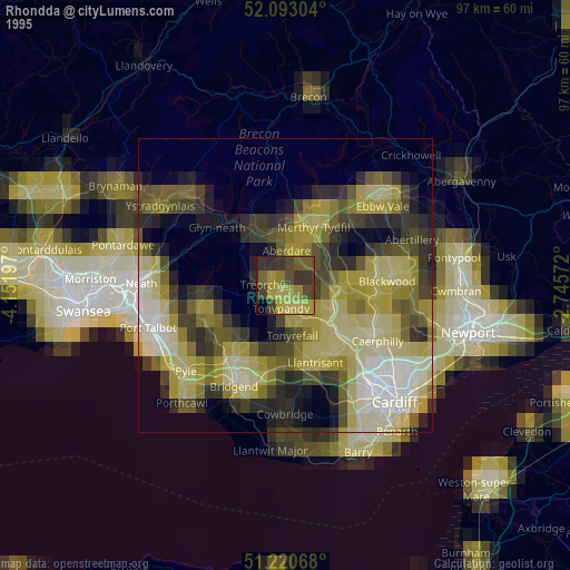
» NASA, Earths city lights 1995
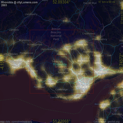
» NASA city lights 2003
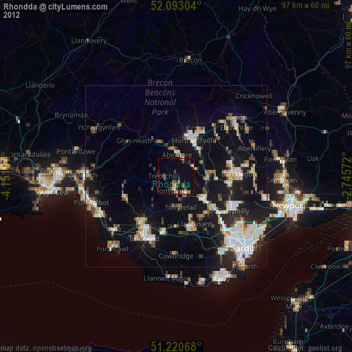
» Earth at Night: Flat Maps 2012, 2016