High Peak night lights from space
Night Light of High Peak (England) from space (United Kingdom) Src. Average luminocity for 10x10km area is 0.6534% and for 50x50km: 18.7819%.
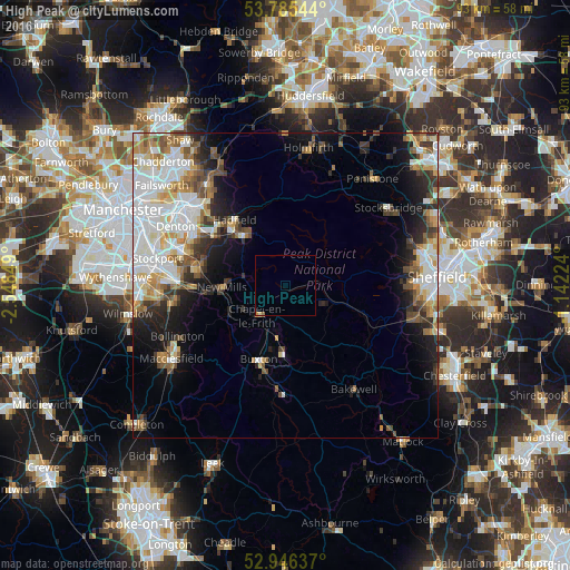
Analysis of High Peak night lights 2016
Square area 10x10 km:
 0%
0%90-99
0%80-89
0.26%70-79
0.26%60-69
0%50-59
0.26%40-49
0%30-39
0%20-29
0%10-19
0%0-9
99.21%Square area 50x50 km:
5.03%90-99
4.13%80-89
1.83%70-79
2.12%60-69
1.93%50-59
2.26%40-49
2.12%30-39
2.18%20-29
3.31%10-19
6.44%0-9
68.65%Clear (daylight) street map image can be seen on geolist.org.
Map coordinates:
53° 47' 7.6" North, 2° 32' 54.6" West
53° 22' 4.7" North, 1° 50' 43.3" West
52° 56' 46.9" North, 1° 8' 32.1" West
Some cities around High Peak sort by population:
• Glossop
10.8 km =6.7 mi,  320°
320°
• Buxton
13 km =8.1 mi,  199°
199°
• Marple
14.7 km =9.1 mi,  281°
281°
• New Mills
10.3 km =6.4 mi,  268°
268°
• Poynton
18.1 km =11.2 mi,  263°
263°
• Longdendale
15 km =9.3 mi, 316°
• Chapel en le Frith
6.6 km =4.1 mi,  222°
222°
• Whaley Bridge
10 km =6.2 mi,  245°
245°
8299617 (p: 92,600)
Sources (retrieved 2019-11-25):
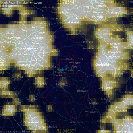
» NASA, Earths city lights 1995
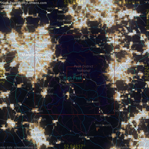
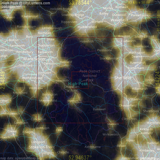
» NASA city lights 2003
» Earth at Night: Flat Maps 2012, 2016