Marple night lights from space
Night Light of Marple (England) from space (United Kingdom) Src. Average luminocity for 10x10km area is 41.8519% and for 50x50km: 29.6804%.
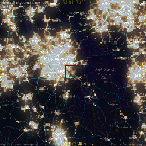
Analysis of Marple night lights 2016
Square area 10x10 km:
 5.95%
5.95%90-99
6.35%80-89
6.61%70-79
3.84%60-69
6.35%50-59
7.54%40-49
6.08%30-39
9.52%20-29
15.08%10-19
19.84%0-9
12.83%Square area 50x50 km:
9.72%90-99
7.13%80-89
2.81%70-79
2.97%60-69
3.26%50-59
3.07%40-49
2.54%30-39
2.68%20-29
3.97%10-19
6.6%0-9
55.25%Clear (daylight) street map image can be seen on geolist.org.
Map coordinates:
53° 48' 42.2" North, 2° 45' 57.7" West
53° 23' 40.3" North, 2° 3' 46.5" West
52° 58' 23.4" North, 1° 21' 35.2" West
Some cities around Marple sort by population:
• Stockport
6.5 km =4 mi,  285°
285°
• Hyde
6.4 km =4 mi,  350°
350°
• Denton
7.8 km =4.8 mi,  332°
332°
• New Mills
5.3 km =3.3 mi,  127°
127°
• Hazel Grove
3.8 km =2.4 mi,  250°
250°
• Bredbury
4.3 km =2.7 mi,  304°
304°
• Poynton
6.1 km =3.8 mi,  215°
215°
• Haughton Green
5.7 km =3.5 mi,  335°
335°
2642999 (p: 18,241)
Sources (retrieved 2019-11-25):
» Earth at Night: Flat Maps 2012, 2016