Longdendale night lights from space
Night Light of Longdendale (England) from space (United Kingdom) Src. Average luminocity for 10x10km area is 39.3307% and for 50x50km: 31.3872%.
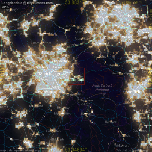
Analysis of Longdendale night lights 2016
Square area 10x10 km:
 6.08%
6.08%90-99
9.13%80-89
4.89%70-79
2.38%60-69
3.97%50-59
6.48%40-49
7.41%30-39
8.73%20-29
11.24%10-19
17.99%0-9
21.69%Square area 50x50 km:
9.67%90-99
7.26%80-89
2.94%70-79
3.02%60-69
3.65%50-59
3.41%40-49
2.93%30-39
2.97%20-29
5.72%10-19
9.27%0-9
49.17%Clear (daylight) street map image can be seen on geolist.org.
Map coordinates:
53° 52' 59.4" North, 2° 42' 11.3" West
53° 28' 0" North, 2° 0' 0" West
53° 2' 45.7" North, 1° 17' 48.8" West
Some cities around Longdendale sort by population:
• Ashton-under-Lyne
7 km =4.3 mi,  290°
290°
• Glossop
4.3 km =2.7 mi,  127°
127°
• Hyde
5.5 km =3.4 mi,  252°
252°
• Denton
7.9 km =4.9 mi,  262°
262°
• Stalybridge
4.4 km =2.7 mi,  296°
296°
• Dukinfield
5.9 km =3.7 mi,  278°
278°
• Mossley
5.8 km =3.6 mi,  336°
336°
• Haughton Green
7.1 km =4.4 mi, 246°
2643704 (p: 8,873)
Sources (retrieved 2019-11-25):
» Earth at Night: Flat Maps 2012, 2016