Hemsworth night lights from space
Night Light of Hemsworth (England) from space (United Kingdom) Src. Average luminocity for 10x10km area is 42.404% and for 50x50km: 39.1344%.
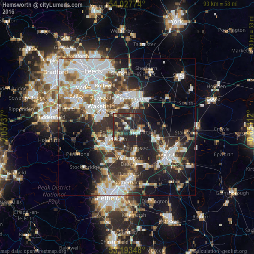
Analysis of Hemsworth night lights 2016
Square area 10x10 km:
 6.19%
6.19%90-99
5.93%80-89
5.18%70-79
5.43%60-69
2.15%50-59
4.42%40-49
4.8%30-39
10.48%20-29
50.51%10-19
4.92%0-9
0%Square area 50x50 km:
9.82%90-99
8.89%80-89
3.56%70-79
4.16%60-69
3.78%50-59
4.28%40-49
4.49%30-39
6.83%20-29
10.97%10-19
13.02%0-9
30.19%Clear (daylight) street map image can be seen on geolist.org.
Map coordinates:
54° 1' 39.9" North, 2° 3' 26.5" West
53° 36' 45.6" North, 1° 21' 15.3" West
53° 11' 36.5" North, 0° 39' 4" West
Some cities around Hemsworth sort by population:
• South Elmsall
5.2 km =3.2 mi,  109°
109°
• Cudworth
6.1 km =3.8 mi,  221°
221°
• Featherstone
7.1 km =4.4 mi,  358°
358°
• Royston
6.5 km =4 mi,  257°
257°
• Darfield
8.9 km =5.5 mi,  189°
189°
• Upton
4.5 km =2.8 mi,  87°
87°
• Crofton
7 km =4.3 mi,  314°
314°
• Ryhill
3.9 km =2.4 mi,  285°
285°
2647120 (p: 9,246)
Sources (retrieved 2019-11-25):
» Earth at Night: Flat Maps 2012, 2016