Ryhill night lights from space
Night Light of Ryhill (England) from space (United Kingdom) Src. Average luminocity for 10x10km area is 45.7854% and for 50x50km: 41.4485%.
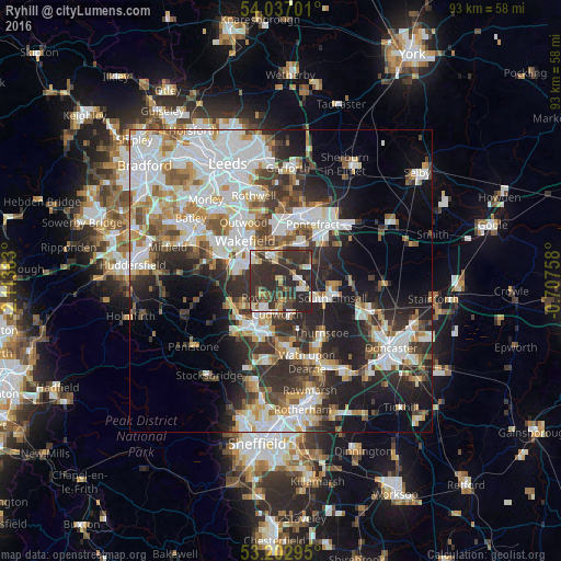
Analysis of Ryhill night lights 2016
Square area 10x10 km:
 5.56%
5.56%90-99
7.32%80-89
4.92%70-79
5.68%60-69
2.53%50-59
5.05%40-49
8.33%30-39
21.21%20-29
39.02%10-19
0.38%0-9
0%Square area 50x50 km:
10.91%90-99
9.77%80-89
3.7%70-79
4.51%60-69
4.17%50-59
4.25%40-49
4.68%30-39
6.73%20-29
11.03%10-19
11.8%0-9
28.44%Clear (daylight) street map image can be seen on geolist.org.
Map coordinates:
54° 2' 13.2" North, 2° 6' 49.8" West
53° 37' 19.3" North, 1° 24' 38.6" West
53° 12' 10.6" North, 0° 42' 27.3" West
Some cities around Ryhill sort by population:
• Wakefield
8.9 km =5.5 mi,  319°
319°
• Darton
8.6 km =5.3 mi,  243°
243°
• Cudworth
5.7 km =3.5 mi,  183°
183°
• Featherstone
7.1 km =4.4 mi,  30°
30°
• Royston
3.6 km =2.2 mi,  226°
226°
• Hemsworth
3.9 km =2.4 mi,  105°
105°
• Upton
8.2 km =5.1 mi,  95°
95°
• Crofton
4 km =2.5 mi,  341°
341°
2638901 (p: 5,150)
Sources (retrieved 2019-11-25):
» Earth at Night: Flat Maps 2012, 2016