Featherstone night lights from space
Night Light of Featherstone (England) from space (United Kingdom) Src. Average luminocity for 10x10km area is 62.5795% and for 50x50km: 37.5501%.
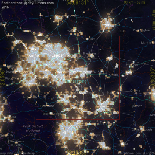
Analysis of Featherstone night lights 2016
Square area 10x10 km:
 18.81%
90-99
16.41%80-89
5.93%70-79
3.79%60-69
3.41%50-59
8.46%40-49
6.31%30-39
13.51%20-29
22.73%10-19
0.63%0-9
0%Square area 50x50 km:
9.32%90-99
8.35%80-89
3.13%70-79
3.9%60-69
3.74%50-59
4.17%40-49
4.39%30-39
7.07%20-29
11.4%10-19
12.22%0-9
32.31%Clear (daylight) street map image can be seen on geolist.org.
Map coordinates:
54° 5' 28.7" North, 2° 3' 34.6" West
53° 40' 36.8" North, 1° 21' 23.3" West
53° 15' 30" North, 0° 39' 12.1" West
Some cities around Featherstone sort by population:
• Wakefield
9.3 km =5.8 mi,  274°
274°
• Castleford
5.5 km =3.4 mi,  355°
355°
• Pontefract
3.3 km =2.1 mi,  61°
61°
• Knottingley
7.4 km =4.6 mi, 62°
• Hemsworth
7.1 km =4.4 mi,  178°
178°
• Upton
8.3 km =5.2 mi,  146°
146°
• Crofton
5.3 km =3.3 mi,  244°
244°
• Ryhill
7.1 km =4.4 mi,  210°
210°
2649593 (p: 11,060)
Sources (retrieved 2019-11-25):
» Earth at Night: Flat Maps 2012, 2016