Cudworth night lights from space
Night Light of Cudworth (England) from space (United Kingdom) Src. Average luminocity for 10x10km area is 53.2121% and for 50x50km: 39.5853%.
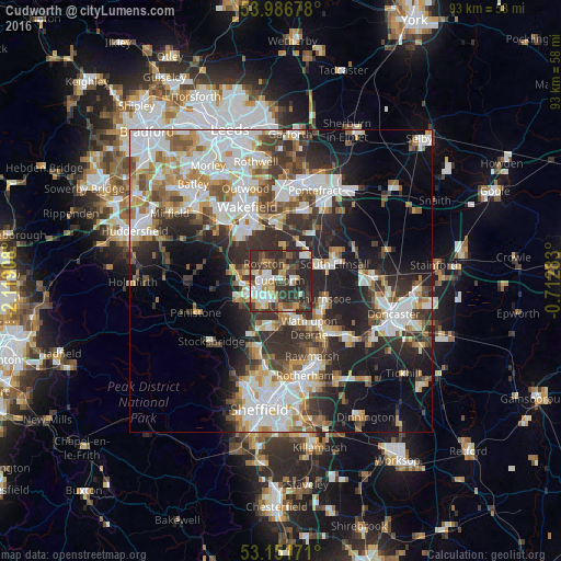
Analysis of Cudworth night lights 2016
Square area 10x10 km:
 8.59%
8.59%90-99
11.24%80-89
4.29%70-79
8.96%60-69
3.54%50-59
6.19%40-49
10.98%30-39
19.07%20-29
26.77%10-19
0.38%0-9
0%Square area 50x50 km:
9.52%90-99
8.88%80-89
3.76%70-79
4.55%60-69
4.23%50-59
4.44%40-49
4.81%30-39
6.82%20-29
11.09%10-19
12.42%0-9
29.48%Clear (daylight) street map image can be seen on geolist.org.
Map coordinates:
53° 59' 12.4" North, 2° 7' 8.7" West
53° 34' 16.7" North, 1° 24' 57.4" West
53° 9' 6.2" North, 0° 42' 46.2" West
Some cities around Cudworth sort by population:
• Barnsley
5 km =3.1 mi,  241°
241°
• Wombwell
5.6 km =3.5 mi,  167°
167°
• Darton
7.5 km =4.7 mi,  283°
283°
• Royston
3.9 km =2.4 mi,  324°
324°
• Hemsworth
6.1 km =3.8 mi,  41°
41°
• Darfield
4.9 km =3 mi,  147°
147°
• Dodworth
8 km =5 mi,  246°
246°
• Ryhill
5.7 km =3.5 mi,  3°
3°
2651778 (p: 11,903)
Sources (retrieved 2019-11-25):
» Earth at Night: Flat Maps 2012, 2016