Upton night lights from space
Night Light of Upton (England) from space (United Kingdom) Src. Average luminocity for 10x10km area is 33.4154% and for 50x50km: 36.6428%.
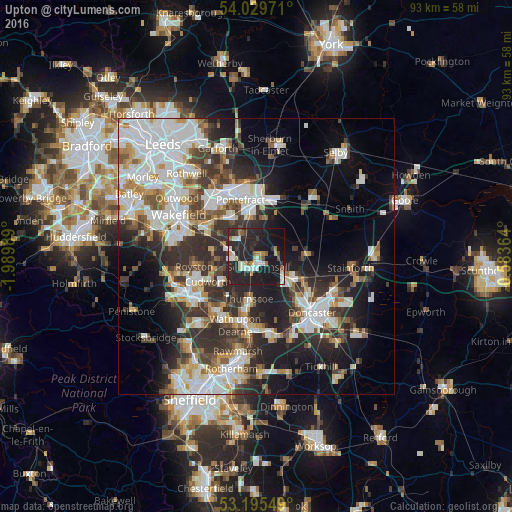
Analysis of Upton night lights 2016
Square area 10x10 km:
 5.05%
5.05%90-99
5.68%80-89
2.65%70-79
3.54%60-69
2.53%50-59
2.78%40-49
2.02%30-39
3.79%20-29
32.2%10-19
34.97%0-9
4.8%Square area 50x50 km:
9.25%90-99
8.27%80-89
3.26%70-79
3.77%60-69
3.13%50-59
3.94%40-49
4.18%30-39
6.6%20-29
10.61%10-19
12.89%0-9
34.09%Clear (daylight) street map image can be seen on geolist.org.
Map coordinates:
54° 1' 47" North, 1° 59' 23.6" West
53° 36' 52.8" North, 1° 17' 12.4" West
53° 11' 43.8" North, 0° 35' 1.1" West
Some cities around Upton sort by population:
• Pontefract
8.7 km =5.4 mi,  348°
348°
• Adwick le Street
8.3 km =5.2 mi,  125°
125°
• South Elmsall
2 km =1.2 mi,  167°
167°
• Featherstone
8.3 km =5.2 mi,  326°
326°
• Hemsworth
4.5 km =2.8 mi,  267°
267°
• Carcroft
8.1 km =5 mi,  115°
115°
• Askern
8.9 km =5.5 mi,  88°
88°
• Ryhill
8.2 km =5.1 mi,  275°
275°
2635090 (p: 5,874)
Sources (retrieved 2019-11-25):
» Earth at Night: Flat Maps 2012, 2016