South Elmsall night lights from space
Night Light of South Elmsall (England) from space (United Kingdom) Src. Average luminocity for 10x10km area is 32.2689% and for 50x50km: 36.2129%.
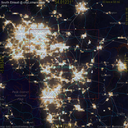
Analysis of South Elmsall night lights 2016
Square area 10x10 km:
 4.92%
4.92%90-99
5.3%80-89
2.15%70-79
3.91%60-69
2.15%50-59
2.02%40-49
2.4%30-39
3.03%20-29
30.05%10-19
40.53%0-9
3.54%Square area 50x50 km:
8.99%90-99
8.11%80-89
3.28%70-79
3.65%60-69
3.08%50-59
3.88%40-49
4.21%30-39
6.66%20-29
10.7%10-19
13.14%0-9
34.29%Clear (daylight) street map image can be seen on geolist.org.
Map coordinates:
54° 0' 44.3" North, 1° 59' 0.5" West
53° 35' 49.5" North, 1° 16' 49.2" West
53° 10' 39.9" North, 0° 34' 38" West
Some cities around South Elmsall sort by population:
• Adwick le Street
7 km =4.3 mi,  114°
114°
• Bolton upon Dearne
9.3 km =5.8 mi,  195°
195°
• Hemsworth
5.2 km =3.2 mi,  289°
289°
• Carcroft
7 km =4.3 mi,  103°
103°
• Darfield
9.4 km =5.8 mi,  221°
221°
• Upton
2 km =1.2 mi,  347°
347°
• Askern
8.7 km =5.4 mi,  75°
75°
• Ryhill
9 km =5.6 mi, 287°
2637435 (p: 18,835)
Sources (retrieved 2019-11-25):
» Earth at Night: Flat Maps 2012, 2016