Helsby night lights from space
Night Light of Helsby (England) from space (United Kingdom) Src. Average luminocity for 10x10km area is 26.0227% and for 50x50km: 38.4805%.
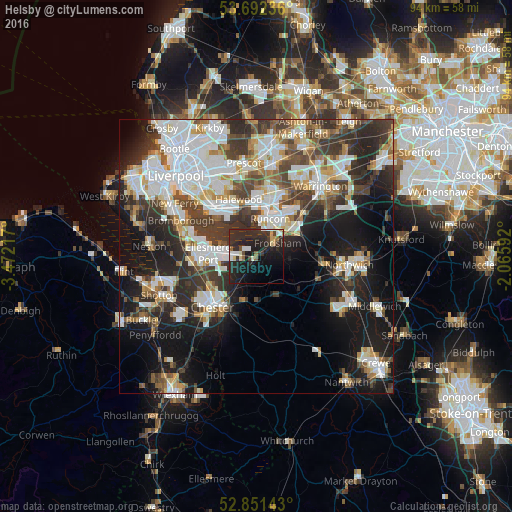
Analysis of Helsby night lights 2016
Square area 10x10 km:
 4.04%
4.04%90-99
3.03%80-89
2.65%70-79
1.52%60-69
0.76%50-59
2.78%40-49
1.64%30-39
4.55%20-29
29.17%10-19
23.99%0-9
25.88%Square area 50x50 km:
10.07%90-99
8.69%80-89
3.41%70-79
3.16%60-69
3.71%50-59
3.73%40-49
5.42%30-39
7.01%20-29
10.29%10-19
16.57%0-9
27.94%Clear (daylight) street map image can be seen on geolist.org.
Map coordinates:
53° 41' 32.5" North, 3° 28' 19.8" West
53° 16' 26.3" North, 2° 46' 8.6" West
52° 51' 5.1" North, 2° 3' 57.3" West
Some cities around Helsby sort by population:
• Chester
12.4 km =7.7 mi,  221°
221°
• Ellesmere Port
8.8 km =5.5 mi,  273°
273°
• Runcorn
7.9 km =4.9 mi,  18°
18°
• Widnes
10 km =6.2 mi,  13°
13°
• Great Sankey
15.7 km =9.8 mi,  33°
33°
• Blacon
12.7 km =7.9 mi,  234°
234°
• Frodsham
3.6 km =2.2 mi,  49°
49°
• Weaverham
13.1 km =8.1 mi,  96°
96°
2647145 (p: 5,166)
Sources (retrieved 2019-11-25):
» Earth at Night: Flat Maps 2012, 2016