Runcorn night lights from space
Night Light of Runcorn (England) from space (United Kingdom) Src. Average luminocity for 10x10km area is 67.4836% and for 50x50km: 44.3075%.
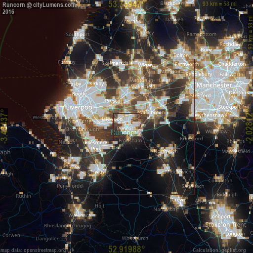
Analysis of Runcorn night lights 2016
Square area 10x10 km:
 20.45%
90-99
20.71%80-89
7.45%70-79
4.67%60-69
4.55%50-59
4.8%40-49
8.21%30-39
11.11%20-29
16.79%10-19
1.26%0-9
0%Square area 50x50 km:
10.83%90-99
9.9%80-89
4.23%70-79
4.23%60-69
4.88%50-59
4.57%40-49
6.63%30-39
8.41%20-29
12%10-19
15.38%0-9
18.94%Clear (daylight) street map image can be seen on geolist.org.
Map coordinates:
53° 45' 34.1" North, 3° 26' 3.7" West
53° 20' 30.3" North, 2° 43' 52.5" West
52° 55' 11.6" North, 2° 1' 41.2" West
Some cities around Runcorn sort by population:
• Warrington
11.5 km =7.1 mi,  60°
60°
• Widnes
2.2 km =1.4 mi,  355°
355°
• Huyton
10.6 km =6.6 mi,  317°
317°
• Great Sankey
8.3 km =5.2 mi,  47°
47°
• Prescot
10.8 km =6.7 mi,  334°
334°
• Frodsham
5.2 km =3.2 mi,  177°
177°
• Stockton Heath
10.9 km =6.8 mi,  72°
72°
• Helsby
7.9 km =4.9 mi,  198°
198°
2638960 (p: 62,872)
Sources (retrieved 2019-11-25):
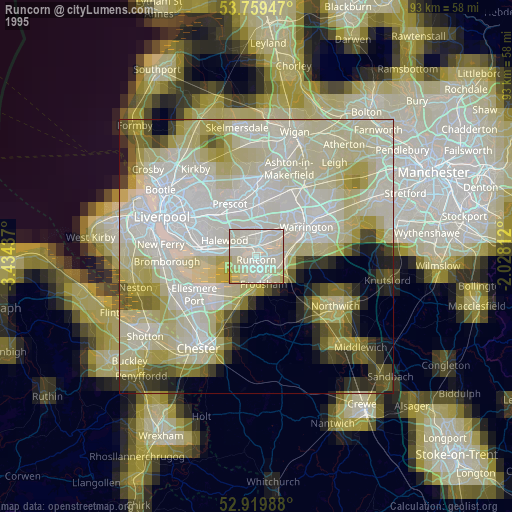
» NASA, Earths city lights 1995
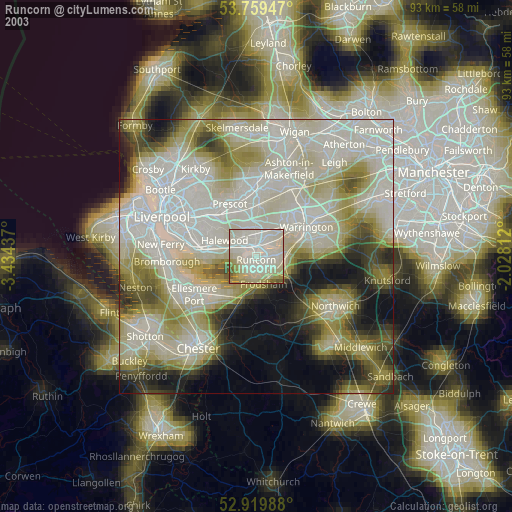
» NASA city lights 2003
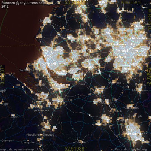
» Earth at Night: Flat Maps 2012, 2016