Widnes night lights from space
Night Light of Widnes (England) from space (United Kingdom) Src. Average luminocity for 10x10km area is 72.0873% and for 50x50km: 45.9401%.
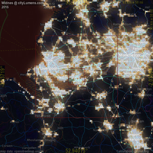
Analysis of Widnes night lights 2016
Square area 10x10 km:
 20.5%
20.5%90-99
21.96%80-89
7.14%70-79
4.1%60-69
7.94%50-59
9.13%40-49
15.74%30-39
9.66%20-29
3.84%10-19
0%0-9
0%Square area 50x50 km:
11.15%90-99
10.23%80-89
4.44%70-79
4.32%60-69
5.22%50-59
4.77%40-49
6.95%30-39
8.86%20-29
12.73%10-19
15.51%0-9
15.81%Clear (daylight) street map image can be seen on geolist.org.
Map coordinates:
53° 46' 45.6" North, 3° 26' 13.9" West
53° 21' 42.5" North, 2° 44' 2.6" West
52° 56' 24.5" North, 2° 1' 51.4" West
Some cities around Widnes sort by population:
• St Helens
9.8 km =6.1 mi,  0°
0°
• Runcorn
2.2 km =1.4 mi,  175°
175°
• Huyton
8.9 km =5.5 mi,  308°
308°
• Great Sankey
7.1 km =4.4 mi,  61°
61°
• Prescot
8.7 km =5.4 mi,  329°
329°
• Frodsham
7.5 km =4.7 mi, 176°
• Stockton Heath
10.7 km =6.6 mi,  84°
84°
• Helsby
10 km =6.2 mi,  193°
193°
2633954 (p: 61,464)
Sources (retrieved 2019-11-25):
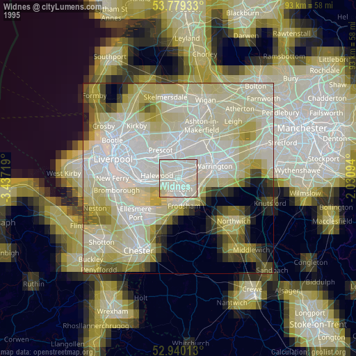
» NASA, Earths city lights 1995
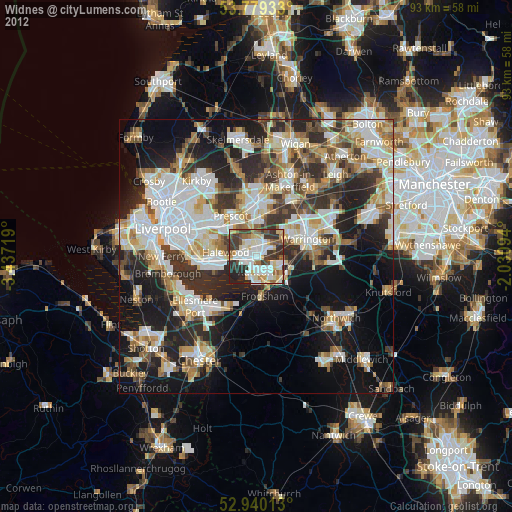
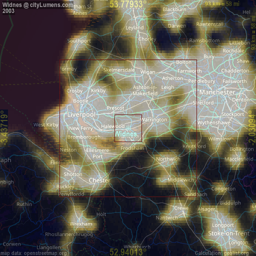
» NASA city lights 2003
» Earth at Night: Flat Maps 2012, 2016