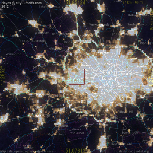
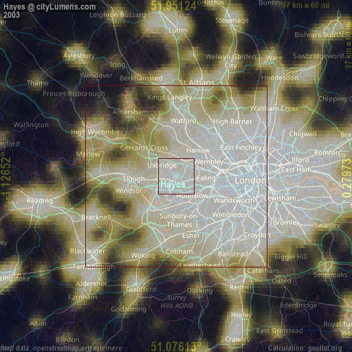
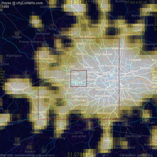
Hayes night lights from space
Night Light of Hayes (England) from space (United Kingdom) Src. Average luminocity for 10x10km area is 94.6364% and for 50x50km: 59.6603%.
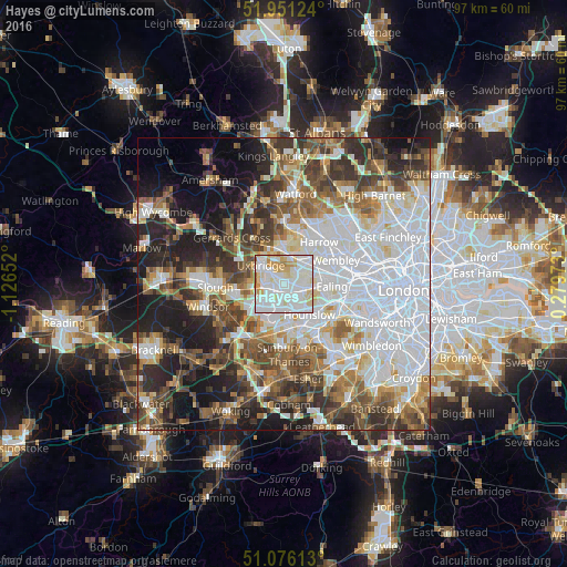
Analysis of Hayes night lights 2016
Square area 10x10 km:
 39.44%
90-99
39.17%80-89
12.3%70-79
6.68%60-69
2.14%50-59
0.27%40-49
0%30-39
0%20-29
0%10-19
0%0-9
0%Square area 50x50 km:
20.09%90-99
12.93%80-89
5.23%70-79
5.1%60-69
6.73%50-59
7.59%40-49
7.91%30-39
7.57%20-29
9.46%10-19
11.28%0-9
6.12%Clear (daylight) street map image can be seen on geolist.org.
Map coordinates:
51° 57' 4.5" North, 1° 7' 35.5" West
51° 30' 56.8" North, 0° 25' 24.2" West
51° 4' 34.1" North, 0° 16' 47" East
Some cities around Hayes sort by population:
• Southall
3.7 km =2.3 mi,  101°
101°
• Hounslow
6.8 km =4.2 mi,  140°
140°
• Greenford
4.9 km =3 mi,  73°
73°
• Ruislip
6.4 km =4 mi,  359°
359°
• Northolt
5.3 km =3.3 mi,  46°
46°
• West Drayton
3.5 km =2.2 mi,  239°
239°
• Iver Heath
6.9 km =4.3 mi,  289°
289°
• Iver
5.6 km =3.5 mi,  251°
251°
2647261 (p: 50,000)
Sources (retrieved 2019-11-25):
» NASA, Earths city lights 1995
» NASA city lights 2003
» Earth at Night: Flat Maps 2012, 2016