Smethwick night lights from space
Night Light of Smethwick (England) from space (United Kingdom) Src. Average luminocity for 10x10km area is 97.2751% and for 50x50km: 41.523%.
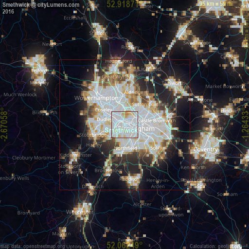
Analysis of Smethwick night lights 2016
Square area 10x10 km:
 51.98%
90-99
37.3%80-89
8.47%70-79
1.46%60-69
0.79%50-59
0%40-49
0%30-39
0%20-29
0%10-19
0%0-9
0%Square area 50x50 km:
12.95%90-99
10.99%80-89
3.43%70-79
3.76%60-69
3.88%50-59
3.14%40-49
3.94%30-39
3.79%20-29
8.29%10-19
14.85%0-9
30.99%Clear (daylight) street map image can be seen on geolist.org.
Map coordinates:
52° 55' 7.4" North, 2° 40' 14.1" West
52° 29' 33.6" North, 1° 58' 2.8" West
52° 3' 45" North, 1° 15' 51.6" West
Some cities around Smethwick sort by population:
• Birmingham
4.7 km =2.9 mi,  105°
105°
• West Bromwich
3.4 km =2.1 mi,  327°
327°
• Halesowen
7.4 km =4.6 mi,  228°
228°
• Aston
5.8 km =3.6 mi,  81°
81°
• Bartley Green
6.7 km =4.2 mi,  197°
197°
• Wednesbury
7.6 km =4.7 mi, 329°
• Hockley
3.5 km =2.2 mi, 76°
• Oldbury
3.4 km =2.1 mi,  283°
283°
2637607 (p: 12,842)
Sources (retrieved 2019-11-25):
» Earth at Night: Flat Maps 2012, 2016