Buckley night lights from space
Night Light of Buckley (Wales) from space (United Kingdom) Src. Average luminocity for 10x10km area is 30.4848% and for 50x50km: 17.8469%.
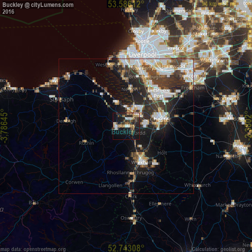
Analysis of Buckley night lights 2016
Square area 10x10 km:
 3.66%
3.66%90-99
4.29%80-89
1.64%70-79
2.4%60-69
6.57%50-59
4.92%40-49
5.56%30-39
5.18%20-29
11.24%10-19
32.32%0-9
22.22%Square area 50x50 km:
3.7%90-99
3.81%80-89
1.57%70-79
1.49%60-69
1.62%50-59
1.76%40-49
2.69%30-39
3.96%20-29
5.76%10-19
8.97%0-9
64.7%Clear (daylight) street map image can be seen on geolist.org.
Map coordinates:
53° 35' 10" North, 3° 47' 11.2" West
53° 10' 0" North, 3° 4' 60" West
52° 44' 35.1" North, 2° 22' 48.7" West
Some cities around Buckley sort by population:
• Deeside
4.8 km =3 mi,  38°
38°
• Flint
9.3 km =5.8 mi,  339°
339°
• Hawarden
4.3 km =2.7 mi,  62°
62°
• Brymbo
11.2 km =7 mi,  174°
174°
• Blacon
11.5 km =7.1 mi,  66°
66°
• Mold
3.9 km =2.4 mi,  270°
270°
• Broughton
6 km =3.7 mi,  93°
93°
• Gresford
11.8 km =7.3 mi,  140°
140°
2654394 (p: 63,576)
Sources (retrieved 2019-11-25):
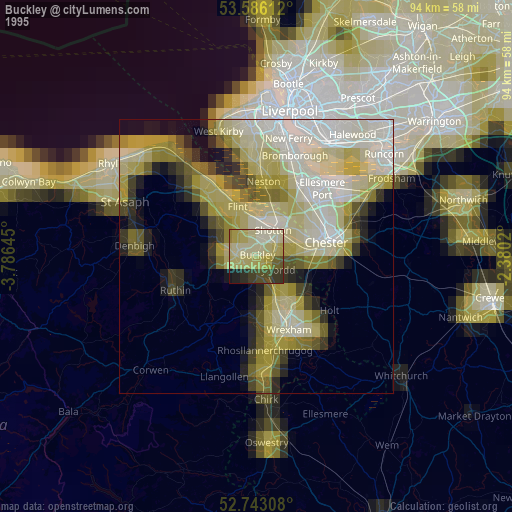
» NASA, Earths city lights 1995
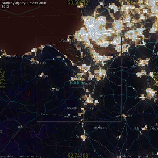
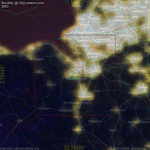
» NASA city lights 2003
» Earth at Night: Flat Maps 2012, 2016