Broughton night lights from space
Night Light of Broughton (Wales) from space (United Kingdom) Src. Average luminocity for 10x10km area is 32.7904% and for 50x50km: 18.7106%.
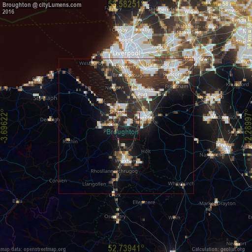
Analysis of Broughton night lights 2016
Square area 10x10 km:
 5.43%
5.43%90-99
4.29%80-89
1.89%70-79
3.54%60-69
4.17%50-59
3.28%40-49
5.05%30-39
4.92%20-29
21.72%10-19
35.1%0-9
10.61%Square area 50x50 km:
3.85%90-99
3.98%80-89
1.74%70-79
1.49%60-69
1.75%50-59
1.83%40-49
2.92%30-39
4.16%20-29
6.12%10-19
9.51%0-9
62.65%Clear (daylight) street map image can be seen on geolist.org.
Map coordinates:
53° 34' 57" North, 3° 41' 46.4" West
53° 9' 46.9" North, 2° 59' 35.1" West
52° 44' 21.9" North, 2° 17' 23.9" West
Some cities around Broughton sort by population:
• Chester
7.4 km =4.6 mi,  65°
65°
• Buckley
6 km =3.7 mi,  273°
273°
• Deeside
5.1 km =3.2 mi,  324°
324°
• Hawarden
3.3 km =2.1 mi, 317°
• Brymbo
11.8 km =7.3 mi,  204°
204°
• Blacon
6.8 km =4.2 mi,  41°
41°
• Mold
9.9 km =6.2 mi, 272°
• Gresford
8.8 km =5.5 mi,  170°
170°
2654507 (p: 5,974)
Sources (retrieved 2019-11-25):
» Earth at Night: Flat Maps 2012, 2016